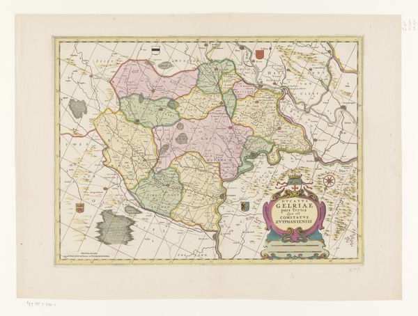
print, etching, engraving
#
aged paper
#
dutch-golden-age
# print
#
etching
#
old engraving style
#
etching
#
architectural drawing
#
engraving
Dimensions: height 163 mm, width 232 mm
Copyright: Rijks Museum: Open Domain
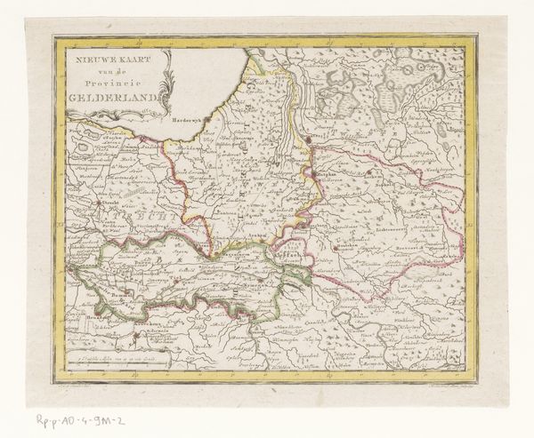
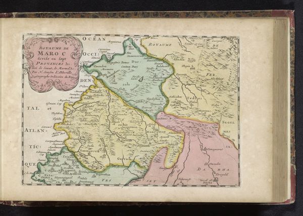
Editor: Here we have an intriguing piece, an anonymous map from the Dutch Golden Age, circa 1635-1696, titled "Kaart van het hertogdom Luxemburg." It's an etching and engraving. What strikes me is the detail, and how this object embodies labor. What can you tell me about it? Curator: For me, the fascination lies in understanding how this map participated in and shaped social and material realities. The printmaking process, the physical labor of the engraver, and the very materiality of the aged paper all speak volumes. What was the economic landscape that necessitated such detailed cartography? Editor: I guess I hadn't thought of it that way. I was mainly thinking about aesthetics. Curator: Aesthetics are relevant, but consider this: the map’s production required specialized labor, the sourcing of materials like copper for the printing plate and specific inks, and a market for its consumption. The seemingly delicate lines and colors of the etching were only possible because of complex trade networks and developing industrial processes of the era. How might this map function as a commodity? Editor: I see what you mean. It wasn't just information; it was something to be bought and sold, like any other product. The material value isn't just the paper and ink but the labor embodied in the object itself. So it gives power to the people who had it? Curator: Precisely. And let’s not forget the role it played in colonial ambitions, territorial disputes, and resource extraction. This map becomes a material witness to those historical processes. Think about its connection to the copper mines, for instance. It is all interconnected. Editor: That makes a lot of sense. Seeing it as more than just a historical document really opens up new avenues of interpretation. Thanks! Curator: Indeed, by centering our attention on the materials, processes, and the historical context of its production, the map reveals itself as an artifact deeply embedded within systems of power, labor, and commerce.
Comments
No comments
Be the first to comment and join the conversation on the ultimate creative platform.
More like this