drawing, print, ink, engraving
#
drawing
#
baroque
#
pen drawing
#
dutch-golden-age
# print
#
landscape
#
ink line art
#
ink
#
geometric
#
engraving
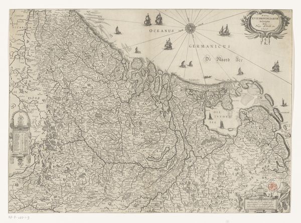
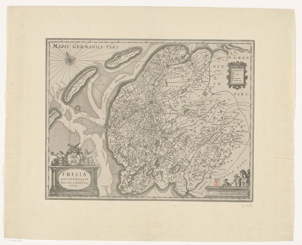
Dimensions: height 396 mm, width 486 mm
Copyright: Rijks Museum: Open Domain
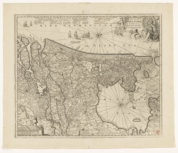
Editor: Here we have Josua van den Enden's 1631 "Kaart van het graafschap Holland," created using ink and engraving techniques. I am struck by how detailed and politically charged cartography could be. What historical narratives do you see embedded in this map? Curator: This map isn’t simply a representation of land; it’s an assertion of power and identity. Consider the Dutch Golden Age: a period of burgeoning trade, colonialism, and fierce independence. Mapping wasn't a neutral activity. How does visualizing their territory empower a young nation-state? Editor: That's interesting. The map clearly delineates Holland, but I wonder how accurate it actually was, given the tools available at the time? Curator: "Accuracy" itself becomes a contested term. Think about who this map was made for. Wealthy merchants? Political elites? What social function did it serve? Editor: I see your point. Perhaps accuracy was less about precise measurements and more about conveying a sense of Dutch control and dominance? I'm thinking of how the seas are prominently labelled and filled with ships. Curator: Precisely! And consider the embellishments, the coats of arms. What lineages and power structures are being invoked? Maps such as this can tell us more about how states used aesthetics to legitimise their authority. The imagery almost overwhelms the literal geography! Editor: Looking closer, it's interesting to think about maps not just as informational tools, but as cultural and political objects, shaping identities and asserting power. Curator: Exactly. By examining such details, we can unearth the complex layers of meaning woven into what might seem like a straightforward depiction of geography.
Comments
No comments
Be the first to comment and join the conversation on the ultimate creative platform.
More like this