drawing, print, ink, engraving
#
drawing
#
pen drawing
#
dutch-golden-age
# print
#
pen illustration
#
pen sketch
#
landscape
#
personal sketchbook
#
ink
#
sketchwork
#
geometric
#
pen-ink sketch
#
line
#
pen work
#
sketchbook drawing
#
cityscape
#
storyboard and sketchbook work
#
sketchbook art
#
engraving
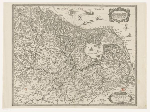
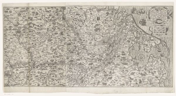
Dimensions: height 382 mm, width 530 mm
Copyright: Rijks Museum: Open Domain
This is Baptista van Doetechum’s map of the Netherlands, made around 1606 with engraving. Notice the intricate network of lines that form the boundaries of provinces, cities, and waterways. The lines create a dense texture across the map, suggesting a region teeming with activity and detail. These graphic elements are not just representational; they actively construct a vision of space, power and knowledge. The map's function extends beyond mere geography; it's a semiotic device. Each symbol—from the sailing ships to the compass rose—acts as a signifier, communicating complex information about trade routes, naval power, and geographical understanding. The map reflects a culture deeply invested in charting its territory and asserting its presence on the world stage. The formal precision and detail speak to the era's pursuit of scientific accuracy and its ambition to codify the world through visual representation.
Comments
No comments
Be the first to comment and join the conversation on the ultimate creative platform.
More like this