print, engraving
#
dutch-golden-age
# print
#
old engraving style
#
landscape
#
linocut print
#
geometric
#
engraving
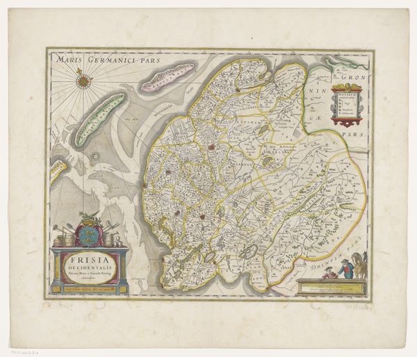
Dimensions: height 380 mm, width 488 mm
Copyright: Rijks Museum: Open Domain
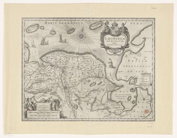
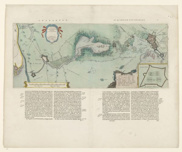
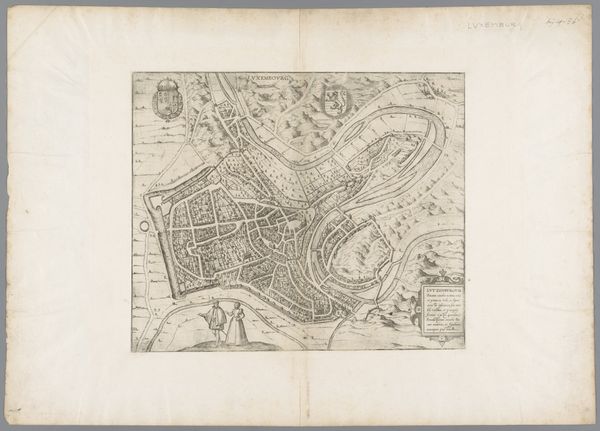
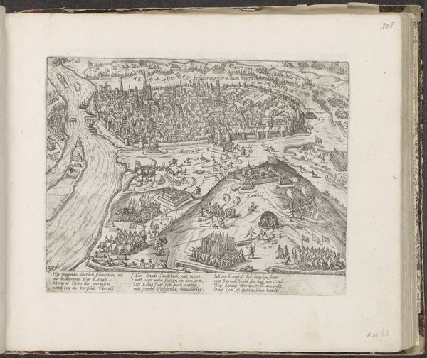
Curator: Welcome. Here we have an early modern print titled "Kaart van Friesland, Vlieland, Terschelling en Ameland", which translates to "Map of Friesland, Vlieland, Terschelling, and Ameland." Its creation is placed sometime between 1629 and 1662, during the Dutch Golden Age. Editor: It has a very detailed, almost dreamlike quality, rendered in monochrome. The shapes are sharp but the details are soft. It feels very removed from the reality it portrays. Curator: Absolutely. It comes to us during a period of tremendous economic and social change in the Netherlands. Maps were more than just geographic tools. They were statements of power and reflected a growing sense of national identity. This print would have served as both a practical guide and a symbol of Dutch maritime prowess. Editor: So, how does the style tie into the politics of its time? I notice the elaborate cartouches—the decorative elements. The focus seems not just about location but also on visually asserting a claim over that landscape. Curator: Precisely. These decorative elements functioned as propaganda, projecting an image of a cultivated and controlled landscape while eliding or even erasing indigenous voices and perspectives. This representation contributed to the construction of Dutch identity and dominance. Editor: So, looking at the representation of the sea, I see this network of trade routes—implying both connectivity and perhaps control over these territories, it also highlights a degree of cultural erasure… what are your thoughts about the style echoing colonialism, for example? Curator: The aesthetic appeal, even today, naturalizes the colonial project. What appears beautiful, is actually deeply political. The very act of mapping is inherently an act of claiming and ordering the world, often with violent consequences for those who already inhabit it. The linework itself participates in power. Editor: It's a striking visual paradox; we can admire the artistry while grappling with its historical implications. These visual products helped naturalize power structures in the early modern world. The act of representation becomes a means of reinforcing existing inequalities. It also challenges us to see maps with criticality, analyzing both their artistry and ideologies. Curator: And it reminds us that historical objects, like this map, should prompt discussion on our modern world. How are geographies, identities, and the act of control continuing in modern cartography? It remains an open invitation to rethink what seems concrete in a geographical image.
Comments
No comments
Be the first to comment and join the conversation on the ultimate creative platform.
More like this