About this artwork
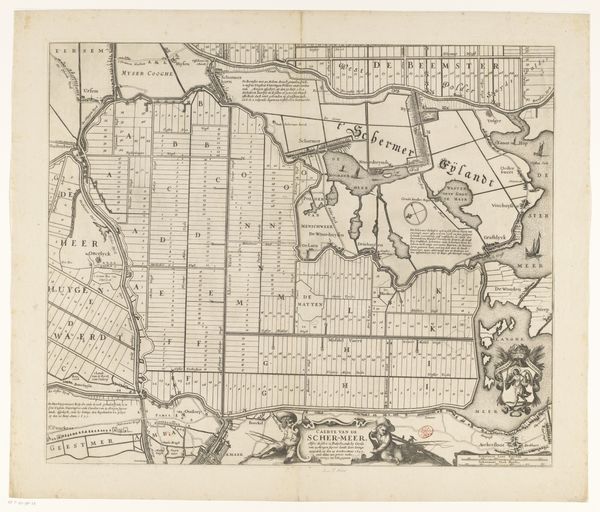
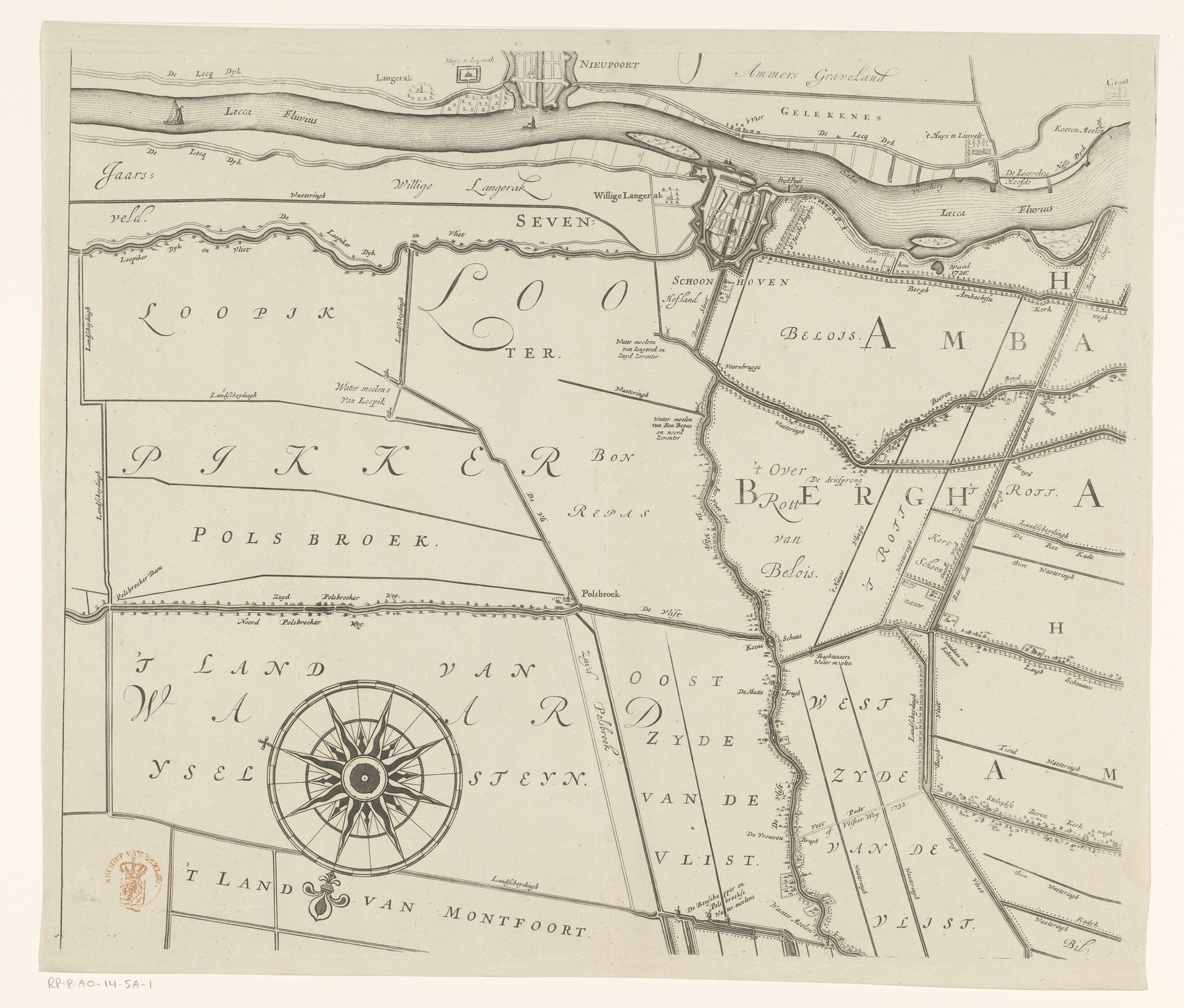
Editor: Here we have a section of "Kaart van het Hoogheemraadschap van de Krimpenerwaard," a map created between 1683 and 1755 by Johannes Leupenius, using pen and ink. The level of detail is striking. How do we read a work like this beyond just geographical data? Curator: That's a great question. Consider the role of cartography in the Dutch Golden Age. Maps weren't just about navigation; they were assertions of power, economic drivers, and reflections of national identity. The Krimpenerwaard was a vital agricultural region, so mapping it served specific socio-political needs. What does its detail suggest to you about the community's relationship to the land? Editor: It looks like a highly organized system with clearly defined boundaries. Maybe land ownership was meticulously recorded, reflecting the economic importance of agriculture. Curator: Exactly! These maps aided in land management, water control—critical in the lowlands—and taxation. How might such a detailed, seemingly objective representation actually shape perceptions and control access to resources? Editor: I suppose it creates a visual hierarchy. Those who controlled the mapping process could influence who had access and power within the region. It almost normalizes a certain power dynamic through seemingly neutral representation. Curator: Precisely. And note the visual style, invoking classicism and scientific accuracy, both highly valued during the period. This imbued the map with authority, shaping its reception. Do you think this adds a layer to its impact? Editor: Definitely. The artistic rendering elevates its perceived trustworthiness, almost as propaganda for an existing social structure, subtly reinforcing it. It's like the art serves power in plain sight! Curator: Precisely! By historicizing something as functional as a map we've discovered some deeper meanings within its construction. Editor: It's been helpful to explore the cultural forces interwoven with practical needs of early map making.
Kaart van het Hoogheemraadschap van de Krimpenerwaard (eerste deel van kaart)
1683 - 1755
Johannes Leupenius
1643 - 1693Location
RijksmuseumArtwork details
- Medium
- drawing, ink, pen
- Dimensions
- height 439 mm, width 530 mm
- Location
- Rijksmuseum
- Copyright
- Rijks Museum: Open Domain
Tags
Comments
Share your thoughts
About this artwork
Editor: Here we have a section of "Kaart van het Hoogheemraadschap van de Krimpenerwaard," a map created between 1683 and 1755 by Johannes Leupenius, using pen and ink. The level of detail is striking. How do we read a work like this beyond just geographical data? Curator: That's a great question. Consider the role of cartography in the Dutch Golden Age. Maps weren't just about navigation; they were assertions of power, economic drivers, and reflections of national identity. The Krimpenerwaard was a vital agricultural region, so mapping it served specific socio-political needs. What does its detail suggest to you about the community's relationship to the land? Editor: It looks like a highly organized system with clearly defined boundaries. Maybe land ownership was meticulously recorded, reflecting the economic importance of agriculture. Curator: Exactly! These maps aided in land management, water control—critical in the lowlands—and taxation. How might such a detailed, seemingly objective representation actually shape perceptions and control access to resources? Editor: I suppose it creates a visual hierarchy. Those who controlled the mapping process could influence who had access and power within the region. It almost normalizes a certain power dynamic through seemingly neutral representation. Curator: Precisely. And note the visual style, invoking classicism and scientific accuracy, both highly valued during the period. This imbued the map with authority, shaping its reception. Do you think this adds a layer to its impact? Editor: Definitely. The artistic rendering elevates its perceived trustworthiness, almost as propaganda for an existing social structure, subtly reinforcing it. It's like the art serves power in plain sight! Curator: Precisely! By historicizing something as functional as a map we've discovered some deeper meanings within its construction. Editor: It's been helpful to explore the cultural forces interwoven with practical needs of early map making.
Comments
Share your thoughts