drawing, print, etching, ink, pen
#
drawing
#
ink drawing
#
pen drawing
#
dutch-golden-age
# print
#
pen illustration
#
pen sketch
#
etching
#
landscape
#
ink
#
ink drawing experimentation
#
geometric
#
pen-ink sketch
#
thin linework
#
pen work
#
sketchbook drawing
#
pen
#
cityscape
#
sketchbook art
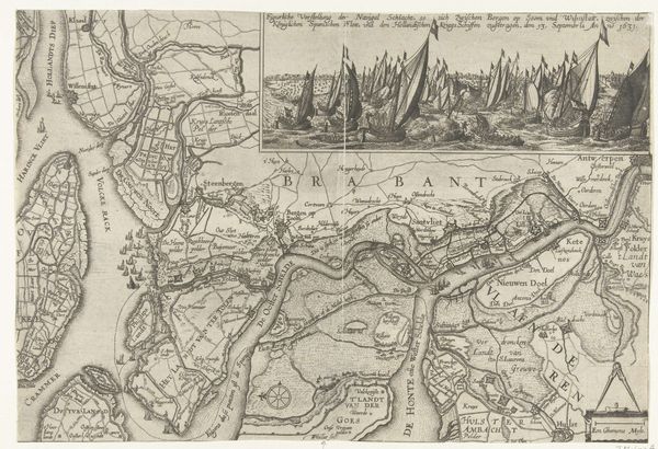
Dimensions: height 410 mm, width 680 mm
Copyright: Rijks Museum: Open Domain
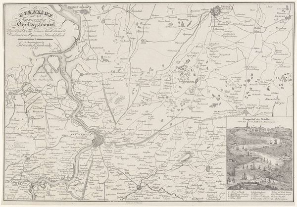
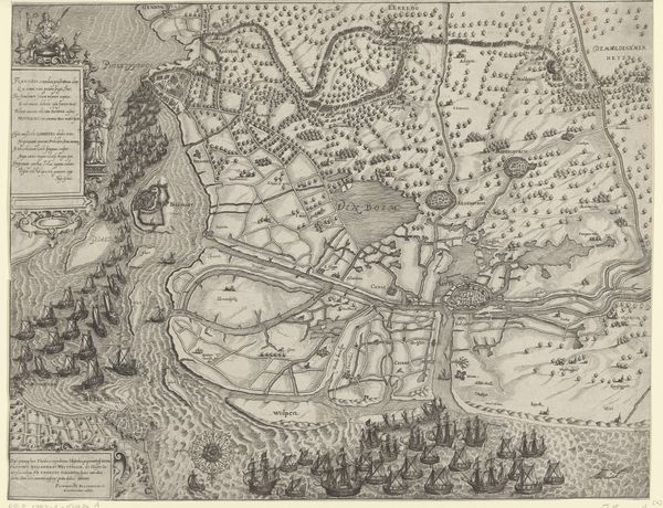
Claes Jansz. Visscher made this map of the Scheldt and the redoubt at Zandvliet with engraving, sometime between 1600 and 1650. It shows the waterways and fortifications around the Scheldt estuary, a crucial zone in the conflict between the Dutch Republic and the Spanish Netherlands. This detailed map isn't just about geography; it's a political statement. During the Eighty Years' War, control of waterways like the Scheldt was strategically vital. Visscher's map highlights Dutch military engineering and territorial claims, emphasizing their power in this contested region. The detailed depiction of the redoubt at Zandvliet underscores its importance in controlling access to Antwerp, a major port city. To fully appreciate this map, one could consult military archives, period pamphlets, and diplomatic correspondence. Understanding the history of cartography as a tool of statecraft sheds light on the political charge of this ostensibly neutral representation. Historical context reveals that this map participated in the struggle to define national identity and assert sovereignty.
Comments
No comments
Be the first to comment and join the conversation on the ultimate creative platform.
More like this