drawing, print, etching
#
drawing
#
16_19th-century
# print
#
etching
#
landscape
#
etching
#
romanticism
#
architectural drawing
#
cityscape
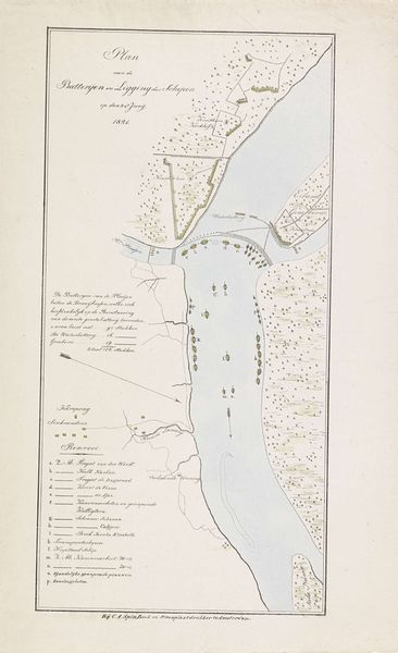
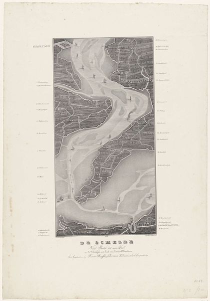
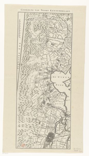
Dimensions: height 521 mm, width 337 mm
Copyright: Rijks Museum: Open Domain
Editor: Here we have "Loop van de Schelde van Fort Bath tot Antwerpen", created around 1832-1833 by Alexander Oltmans. It’s an etching and print that depicts a sort of bird's-eye view map of the Schelde river. What catches my eye is how detailed and technical it seems. What do you make of it? Curator: Well, right away I’m drawn to consider this etching in terms of production and its potential social function. Look at the detail, created via the laborious process of etching. The networks of trade and exchange become visible, materially manifested through this landscape. What level of skill was required to produce this, and for whom was this detailed level of information necessary? Editor: That’s a really interesting way to look at it. So, instead of just seeing it as a historical landscape, you’re focusing on the effort and social purpose embedded in its making. The artist’s labour is important? Curator: Precisely! Consider the role of Antwerp as a port city. The map isn’t just a depiction; it's a tool for navigating trade routes, perhaps a symbol of power and control over the river Schelde. It speaks to a very specific type of consumption and practical knowledge that holds value. And, also notice how the romantic style could suggest more aesthetic values to this detailed map, blurring the line between the "useful" and art. Editor: Ah, I see. It's almost like the map becomes a commodity in itself, not just representing a location. It’s fascinating to think about the skilled work involved, turning geography into a valuable object. Curator: Exactly! It allows us to rethink how boundaries between art, craft, and labour get blurred when we focus on materiality. This isn't just a pretty picture; it's a record of material engagement. Editor: That really changes my perspective on the work. Now I see it less as a distant historical document and more as a trace of real labor and a record of material and social relationships. Thank you! Curator: Indeed! I also hadn’t quite considered the degree to which this is in between “technical document” and “romantic vista,” something I'll keep in mind moving forward.
Comments
No comments
Be the first to comment and join the conversation on the ultimate creative platform.
More like this