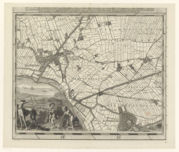
graphic-art, print, etching
#
graphic-art
#
dutch-golden-age
# print
#
etching
#
landscape
#
etching
Dimensions: height 519 mm, width 600 mm
Copyright: Rijks Museum: Open Domain
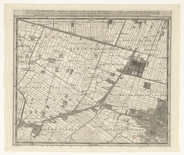
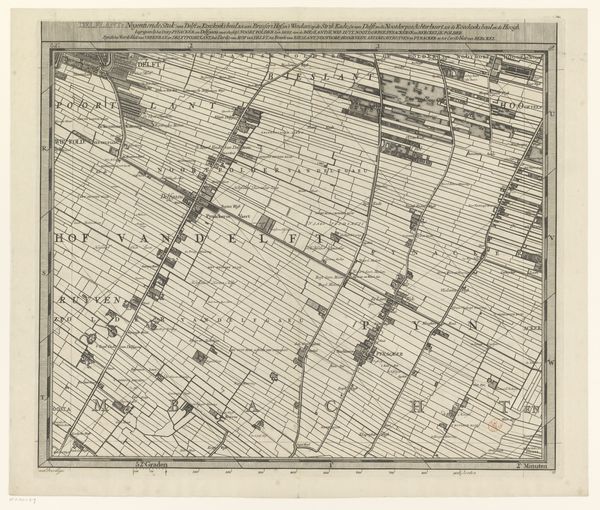
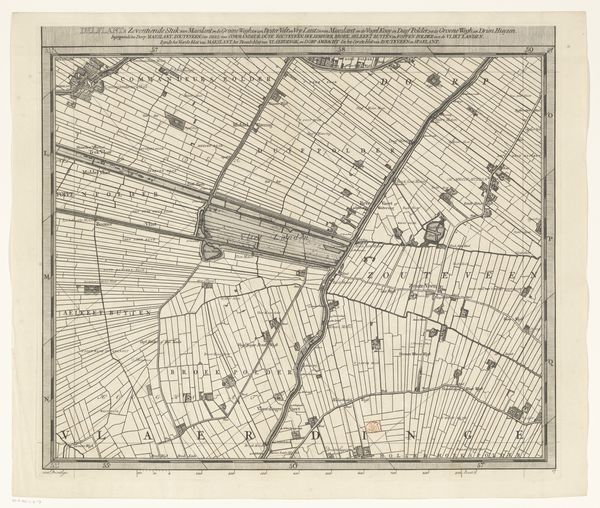
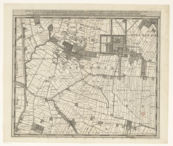
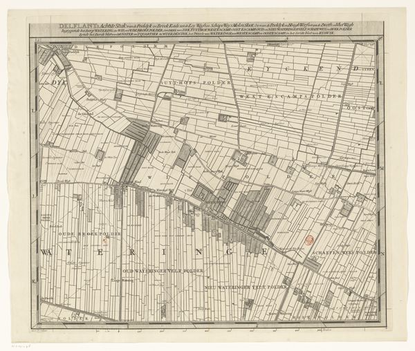
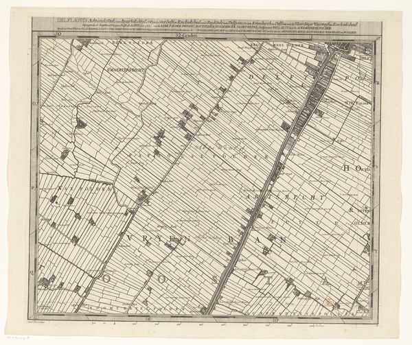
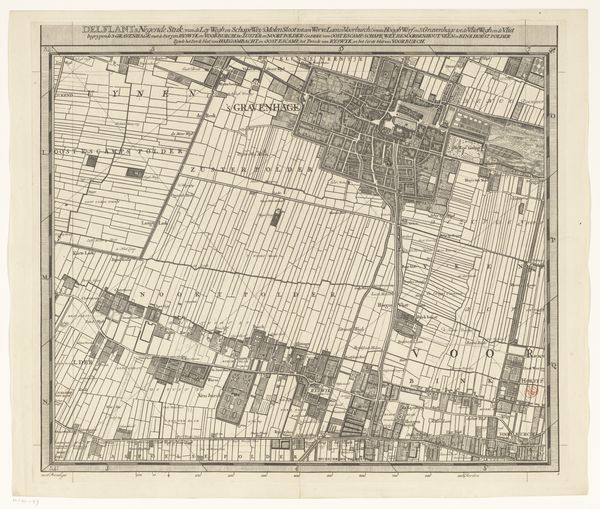
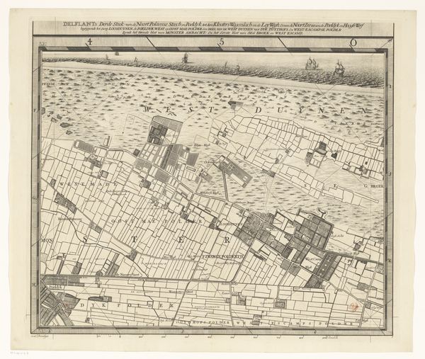
Curator: Editor: We're looking at Luggert van Anse's "Map of the Delfland Water Authority (part fourteen)", created between 1712 and 1735, using etching techniques. It reminds me a little of landscapes, but from an unusual birds-eye perspective! What social narratives do you see reflected in this map? Curator: That’s a very insightful observation. Look closer: This isn’t just about geography, it's about power. Notice how the landscape is meticulously divided, controlled? It shows how the Dutch Golden Age was constructed, quite literally, on the management and control of water and land. Consider what that signifies regarding labor, ownership, and social structures of the time. Editor: So the etching is showing how land was being claimed and controlled during that period? The names of areas also feel relevant, for some reason. Curator: Precisely. Maps weren't objective documents, but instruments of control and visions of what a specific society found valuable, with lands meticulously named and borders drawn. Van Anse's detailed depiction hints at the ongoing tension between nature, human intervention, and the enforcement of social order that we now take for granted. Who benefited from the 'reclamation' that is at the root of these changes to the natural landscape? Editor: So it makes you think about land rights, colonialism… It definitely makes me reconsider maps not just as tools, but as statements. Thank you! Curator: My pleasure. Seeing art this way encourages us to think about how our world is structured and by whom.
Comments
No comments
Be the first to comment and join the conversation on the ultimate creative platform.
More like this