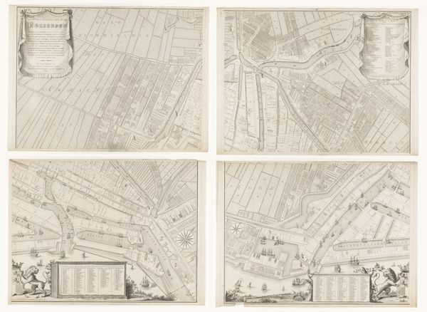
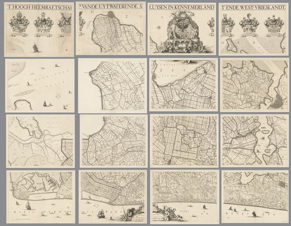
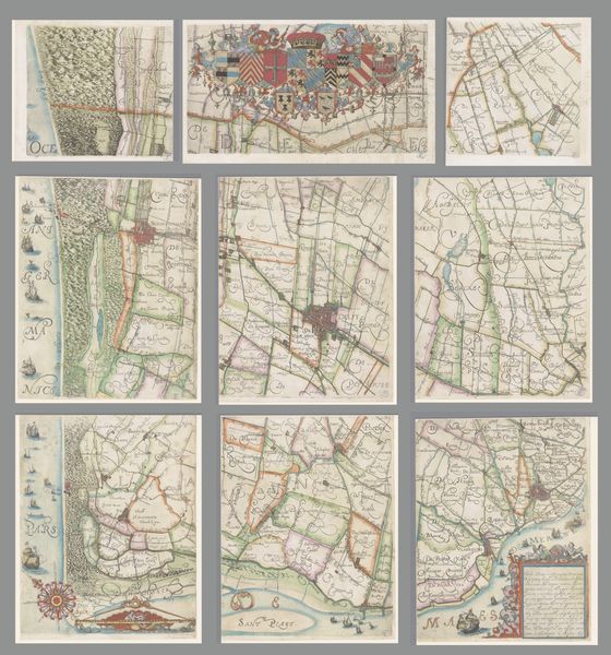
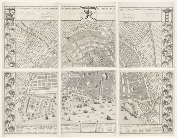
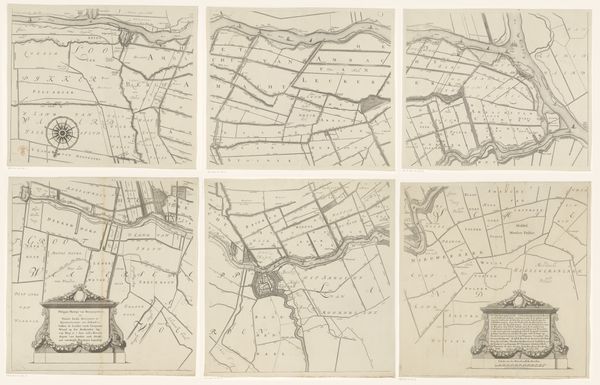
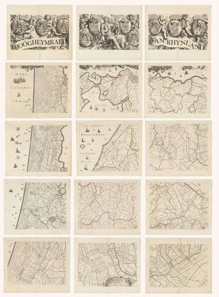
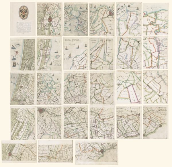
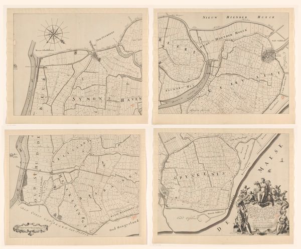
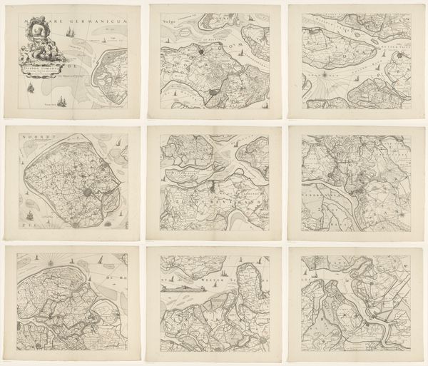
Kaart van het Hoogheemraadschap van Delfland, bestaande uit vijfentwintig delen 1712 - 1735
0:00
0:00
print, paper, engraving
#
baroque
# print
#
landscape
#
paper
#
cityscape
#
engraving
Dimensions: height 2200 mm, width 2625 mm
Copyright: Rijks Museum: Open Domain
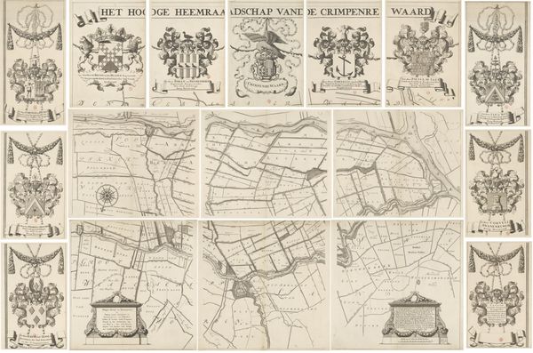
Curator: This work, "Kaart van het Hoogheemraadschap van Delfland, bestaande uit vijfentwintig delen," created between 1712 and 1735 by Luggert van Anse, offers a fascinating glimpse into the past. The piece is an engraving on paper. Editor: It strikes me immediately as a tapestry of lines, almost a textile rendered in monochrome. There’s a fascinating tension between the rigid grid and the organic sprawl of the landscape details. Curator: Indeed. What’s intriguing to consider is the socio-political purpose behind its creation. This map meticulously charts Delfland, revealing the intricate network of waterways essential for land management and governance in the Netherlands during the early 18th century. Think about the power dynamics inherent in representing land, especially reclaimed land. Editor: The sheer detail is captivating—the precision with which these waterways and land divisions are rendered speaks to an acute observational power. There is also a baroque sensibility to it, with ornamental details surrounding some of the segments. Curator: Yes, that level of precision was directly linked to power. These maps were instrumental for taxation, resource allocation, and legal jurisdiction, influencing the daily lives and livelihoods of those inhabiting the Delfland region. Note how it’s organized into 25 distinct sections, each its own mini-landscape, together illustrating this intersection between landscape, control and ownership. Editor: And it brings up questions about representation. By breaking the terrain into these measured parts, the creator imposes an order. What perspective did Anse bring to this? It's not just a functional map; it reflects the values and ideology of the time, wouldn't you say? Curator: Absolutely. Consider that these representations helped solidify control and authority. Who owned the means to commission and interpret these maps and benefited from their dissemination? This artwork represents the relationship between those that have and those that don’t. Editor: It prompts a fresh consideration of landscapes that often feel timeless. When we analyze cartography using modern methodology we arrive at deeper appreciation of both geography and artwork, while reflecting on the human drive to capture and codify nature’s wonders. Curator: A deeper appreciation of our current environment starts by understanding historical approaches like these, what we decided to keep and discard along the way. Editor: Agreed, and perhaps a lesson about how art shapes the landscape of knowledge itself.
Comments
No comments
Be the first to comment and join the conversation on the ultimate creative platform.
More like this