drawing, ink, pen
#
drawing
#
dutch-golden-age
#
pen sketch
#
landscape
#
personal sketchbook
#
ink
#
sketchwork
#
ink drawing experimentation
#
geometric
#
pen-ink sketch
#
pen work
#
sketchbook drawing
#
pen
#
storyboard and sketchbook work
#
sketchbook art
#
initial sketch
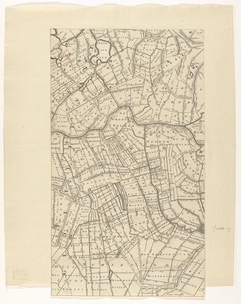
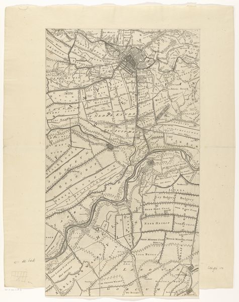
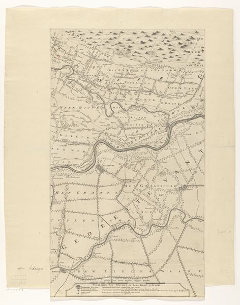
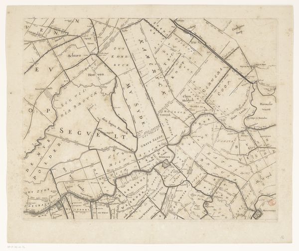
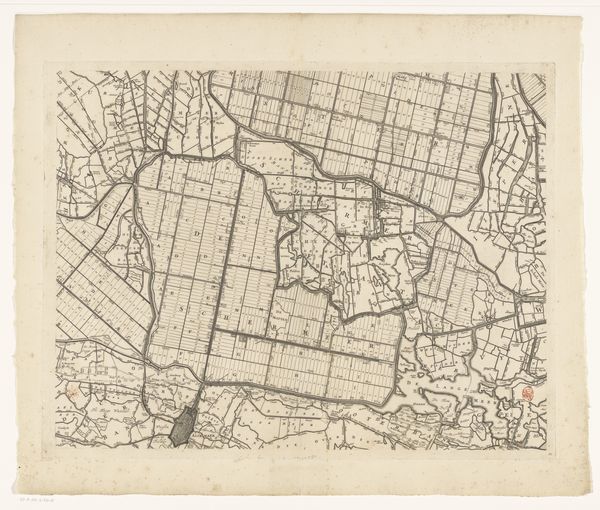
Dimensions: height 641 mm, width 372 mm
Copyright: Rijks Museum: Open Domain
Curator: Here we have "Kaart van de provincie Utrecht (tweede deel van onder)," a map of the province of Utrecht created by Thomas Doesburgh after 1696. It's rendered in pen and ink. Editor: My first thought? This is a world built on right angles. Fields, waterways, everything seems to adhere to a grid. I wonder what that meant for the people living within it. Curator: Well, the Dutch Golden Age was a period of significant land reclamation and agricultural innovation. Maps like these were not just geographic tools, but also instruments of power and control. The act of mapping the land imposed a certain order upon it, facilitating resource management and taxation. It represents the claiming and taming of nature. Editor: So, a reflection of a very specific societal ambition then? It's a bit sobering when you think about it. Like looking at a very ordered ant farm. But there is still a strange beauty in its precise execution. A world in lines. I can almost feel the scratch of the pen on the paper. Curator: Indeed, this wasn't just about land; it was also about solidifying a national identity. Think of how much the land determines how societies behave within and relate to others, which comes through, of course, in the region's cartography. The meticulous detail would have conveyed not just geographical information, but also the competence and ambitions of the Dutch Republic. Editor: Maps always tell stories beyond simple geography, don’t they? I keep thinking of what's omitted, not shown, suppressed by this linear world, literally white space to the power. It's strangely confrontational to think that that order came at the expense of…something unnamed, something more human or capricious. Curator: Absolutely. When viewed through the lens of, say, feminist theory, one might explore how this mapping represents a patriarchal impulse to control and delineate space, mirroring societal structures of dominance. Whose stories were silenced in the making of this map? Editor: That tension, between beauty and the invisible costs of order... that is really haunting. Like a very old lesson etched in ink. Curator: It pushes us to contemplate maps less as objective renderings of space and more as culturally and politically contingent documents. Editor: Next time I reach for a map, I’m definitely going to think twice about where I am actually going, or being directed to go!
Comments
No comments
Be the first to comment and join the conversation on the ultimate creative platform.
More like this