drawing, print
#
drawing
#
dutch-golden-age
# print
#
landscape planning
#
landscape
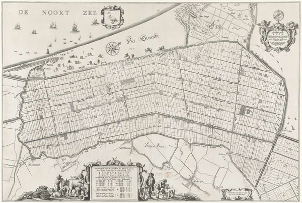
Dimensions: height 510 mm, width 653 mm
Copyright: Rijks Museum: Open Domain
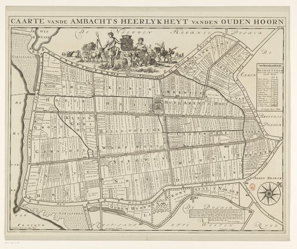
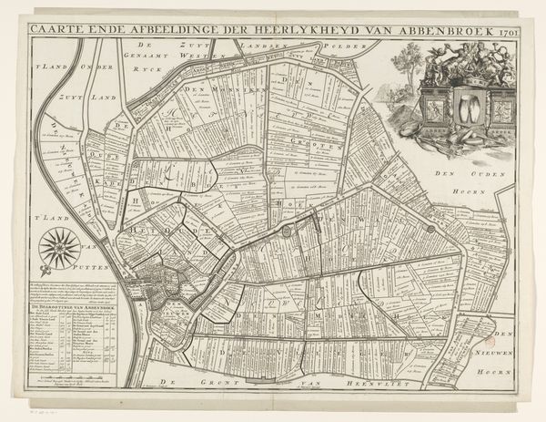
This is a hand-colored engraving, representing the district of Oudenhoorn, made by Jan Stemmers. The original drawing would have been done with painstaking care, mapping each field, road, and waterway. The character of the print comes from a combination of skilled labor and the techniques of reproduction. The original lines would have been carefully incised into a metal plate, which was then inked and pressed onto paper. The colouring would then have been added by hand. Notice the regimented divisions of space: this is not just a picture of a place, but a visualisation of land as property. Each of those parcels would have been associated with labour, production, and profit. Maps like these facilitated the Dutch mastery of trade and colonization, dependent as they were on precisely accounting for resources. Consider the amount of labor involved in this kind of project. This map is a testament to the close relationship between aesthetics, craft and the rise of capitalism.
Comments
No comments
Be the first to comment and join the conversation on the ultimate creative platform.
More like this