drawing, print, pen, engraving
#
drawing
# print
#
landscape
#
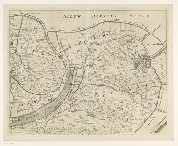
geometric
#
pen work
#
pen
#
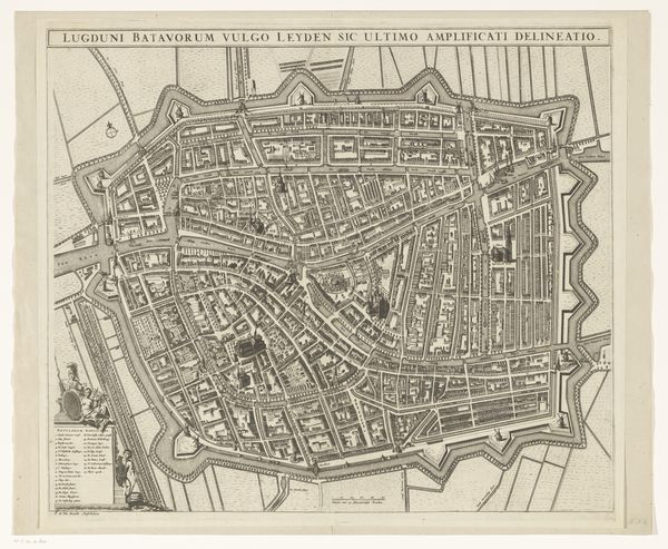
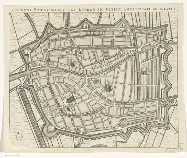
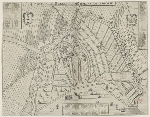
cityscape
#
engraving
Dimensions: height 506 mm, width 676 mm
Copyright: Rijks Museum: Open Domain
Editor: This detailed map, titled "Kaart van de heerlijkheid Abbenbroek," from 1701, by Jan Stemmers, uses drawing, print, pen and engraving techniques. The dense network of lines and symbols is striking. What hidden meanings or cultural references do you find embedded within this seemingly straightforward representation of land? Curator: A map is never merely a factual depiction; it’s a symbolic act of claiming space, imbued with the cultural values of its creators. What repeated shapes or symbols stand out to you, and what feelings do they stir? Editor: The long, narrow rectangles filling much of the area—perhaps fields? And the presence of decorative elements alongside the practical cartography seems important. Curator: The rectangles, meticulously demarcated, speak of cultivated land, ownership, and the social structures that control resources. Notice how the embellishments – the flourishes, the title cartouche – function. How do they influence your perception of the territory being mapped? Editor: I see, they almost elevate the mundane, turning land management into something of status or even beauty. The act of mapping itself becomes a statement. Curator: Precisely! The symbolic weight extends beyond pure functionality. Consider the compass rose. What feelings and associations are commonly linked to such symbols on old maps? Editor: Navigation, exploration, a sense of dominion, perhaps even a claim on the unknown… Curator: Exactly. Even the act of orienting oneself – of ‘knowing one’s place’ – can be viewed through the lens of power. This map does more than show; it tells a story about the relationship between people, land, and control. Editor: I see the land less as a place, and more as a representation of values, class, and social standing at the time. I never thought a map could carry so much meaning! Curator: Maps speak a symbolic language, whispering tales of cultural memory and human ambition. They transform space into a narrative we can all interpret.
Comments
No comments
Be the first to comment and join the conversation on the ultimate creative platform.
More like this