About this artwork
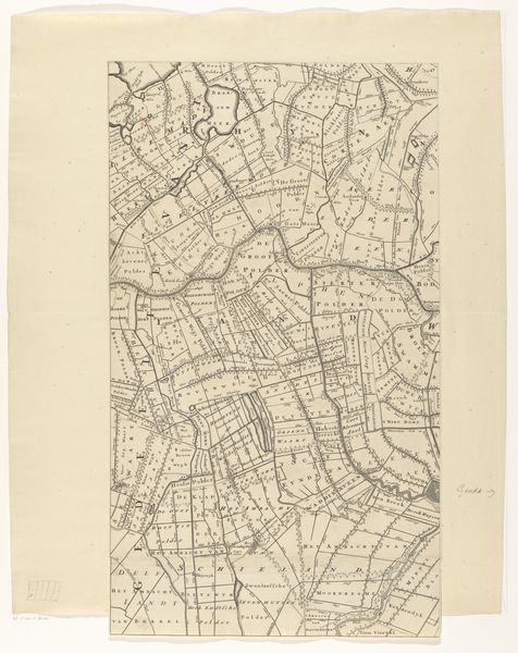
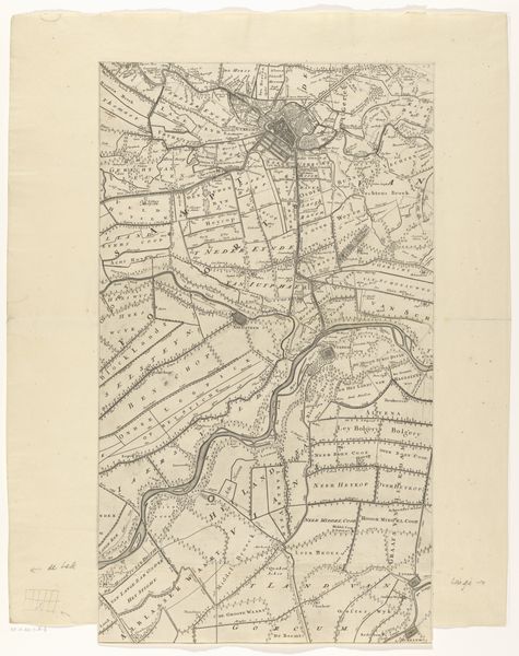
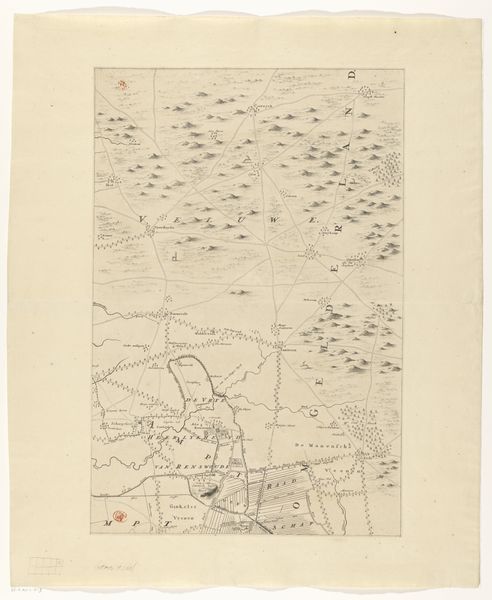
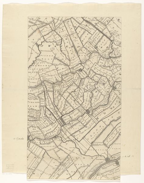
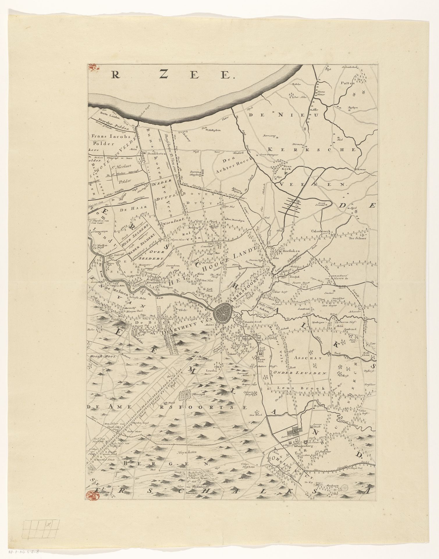
Editor: So, here we have a section of "Kaart van de provincie Utrecht," a map of the Utrecht province created after 1696, attributed to Thomas Doesburgh. It's an engraving, a print… It feels so precise, like an almost scientific observation, but at the same time, something about it seems dreamlike, like peering into another world, meticulously crafted. What catches your eye when you look at this piece? Curator: Oh, my dear, "dreamlike" is spot-on! It's the blend of the factual and the imagined, isn't it? Think of it: Before satellite imagery, the rendering of landscape *was* an act of imaginative reconstruction as much as a scientific record. Doesn't this suggest the laborious act of walking the land, feeling its contours? The details of this etching suggest something about control and perspective that seems distinctly Dutch, right? So controlled, this tiny portion, with an undertone of...almost poetry in the line work. What about you? Any other feeling for it? Editor: The detail is extraordinary! The names of all the little fields and waterways. I can't imagine documenting an area with so much specificity! It makes me want to visit Utrecht as it was back then! Curator: Haha, don't we all harbor the desire to be transported by cartography? The appeal comes not only from our ability to see the known from a height, as though divinely ordained but also a time now gone. Did that world ever actually exist except in our memory? Maybe. This kind of print allows me to think about land, about property, about who *possessed* this landscape. It’s an incredible thought! Editor: That's a great point – seeing it as a representation of ownership and control. It does add a layer of complexity, doesn’t it? Curator: Absolutely. Now you're starting to sound like a curator!
Kaart van de provincie Utrecht (vierde deel van boven)
after 1696
Thomas Doesburgh
@thomasdoesburghLocation
RijksmuseumArtwork details
- Medium
- print, engraving
- Dimensions
- height 559 mm, width 373 mm
- Location
- Rijksmuseum
- Copyright
- Rijks Museum: Open Domain
Tags
Comments
Share your thoughts
About this artwork
Editor: So, here we have a section of "Kaart van de provincie Utrecht," a map of the Utrecht province created after 1696, attributed to Thomas Doesburgh. It's an engraving, a print… It feels so precise, like an almost scientific observation, but at the same time, something about it seems dreamlike, like peering into another world, meticulously crafted. What catches your eye when you look at this piece? Curator: Oh, my dear, "dreamlike" is spot-on! It's the blend of the factual and the imagined, isn't it? Think of it: Before satellite imagery, the rendering of landscape *was* an act of imaginative reconstruction as much as a scientific record. Doesn't this suggest the laborious act of walking the land, feeling its contours? The details of this etching suggest something about control and perspective that seems distinctly Dutch, right? So controlled, this tiny portion, with an undertone of...almost poetry in the line work. What about you? Any other feeling for it? Editor: The detail is extraordinary! The names of all the little fields and waterways. I can't imagine documenting an area with so much specificity! It makes me want to visit Utrecht as it was back then! Curator: Haha, don't we all harbor the desire to be transported by cartography? The appeal comes not only from our ability to see the known from a height, as though divinely ordained but also a time now gone. Did that world ever actually exist except in our memory? Maybe. This kind of print allows me to think about land, about property, about who *possessed* this landscape. It’s an incredible thought! Editor: That's a great point – seeing it as a representation of ownership and control. It does add a layer of complexity, doesn’t it? Curator: Absolutely. Now you're starting to sound like a curator!
Comments
Share your thoughts