drawing, paper, ink
#
drawing
#
aged paper
#
light pencil work
#
baroque
#
pen sketch
#
landscape
#
paper
#
personal sketchbook
#
ink
#
ink drawing experimentation
#
geometric
#
pen-ink sketch
#
ink colored
#
sketchbook drawing
#
watercolour illustration
#
sketchbook art
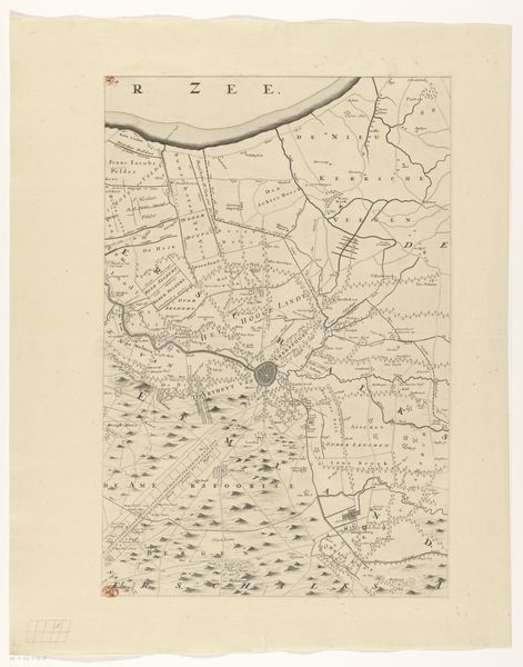
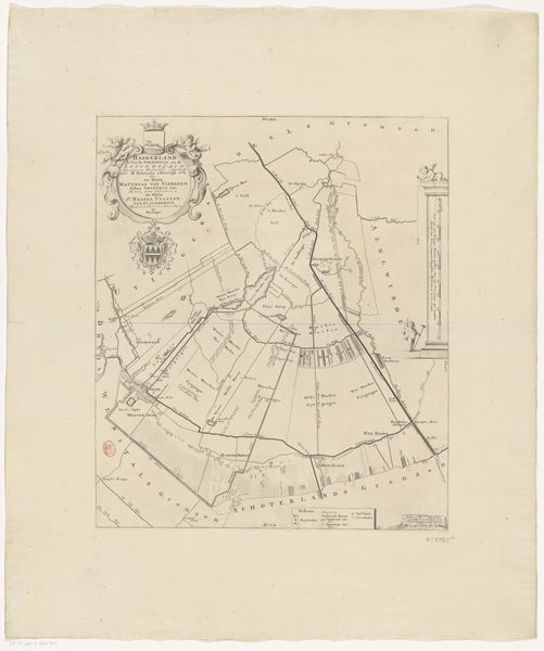
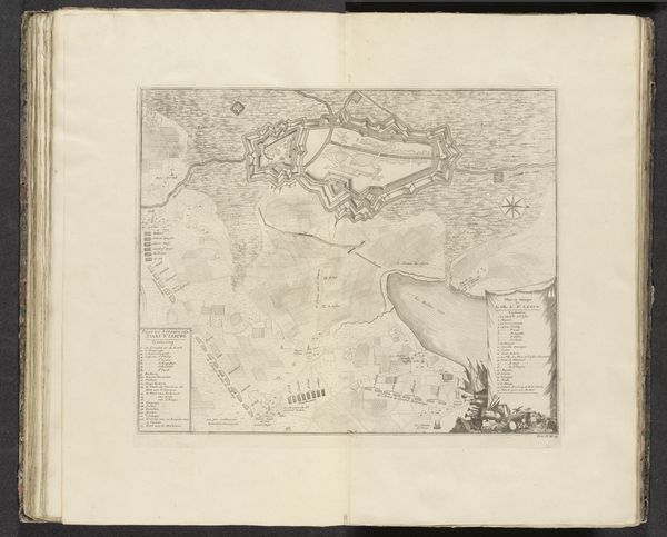
Dimensions: height 557 mm, width 371 mm
Copyright: Rijks Museum: Open Domain
Curator: We're looking at a fascinating drawing here at the Rijksmuseum titled "Kaart van de provincie Utrecht (vijfde deel van boven)," which translates to "Map of the province of Utrecht (fifth part from above)." It dates back to sometime after 1696 and is credited to Thomas Doesburgh. Editor: It's incredibly delicate. At first glance, I see a landscape of whispers, rendered in the faintest of ink. So light that the paper seems almost untouched. Curator: The medium itself plays a role. It's an ink and pencil drawing on paper. Knowing that, we understand it’s part art, part craft – a blend reflecting both the meticulousness of cartography and artistic interpretation. Editor: Indeed. And looking closer, you can really feel the artist's hand. This isn't a printed map but rather a handcrafted artifact. It reminds me of a survey, recording information related to land use and administration during the Baroque. Curator: Absolutely. Think about what it meant to create such a document then. It was painstaking work and I suspect there was extensive patronage behind works like these. The drawing also reflects more than utility; see the artist using watercolor washes that gives a textural feel. I'd imagine Doesburgh walked these lands! Editor: Or perhaps it's a collection of mediated reports of these spaces? Either way, consider the material's availability; good quality paper would’ve been quite precious! You start wondering who commissioned the map, and the hands involved in its production. It connects us directly to a very particular time and social web. Curator: The precision and artistry elevate what would be strictly a technical drawing to something sublime. I find this really impressive. What begins as simply paper and ink becomes almost otherworldly! Editor: Agreed, and what it communicates transcends its practical function as a guide. You end up reflecting on labour and land. We must also remember what "province" signified in the Netherlands then, especially since the borders had become such contested zones! Curator: You are right, a map is never a neutral piece. It serves a purpose of asserting influence, doesn't it? Editor: It's all intertwined—utility, beauty, politics and materiality! All whispering to each other over time.
Comments
No comments
Be the first to comment and join the conversation on the ultimate creative platform.
More like this