drawing, print, ink, engraving
#
drawing
# print
#
pen illustration
#
pen sketch
#
old engraving style
#
ink
#
geometric
#
history-painting
#
academic-art
#
engraving
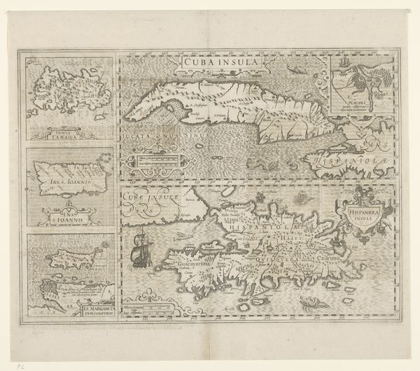
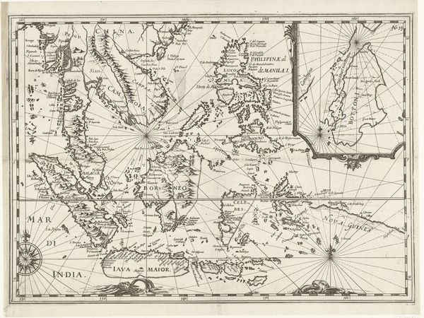
Dimensions: height 135 mm, width 170 mm
Copyright: Rijks Museum: Open Domain
This is an anonymous map of the island of São Tomé, made in 1602. It’s a fascinating artifact that reflects the intersection of geography, trade, and colonialism. The map creates meaning through visual codes typical of its time. Look at the compass rose, the decorative rendering of mountains, and the sailing ship; these elements speak to the aspirations and technologies of European exploration. São Tomé, located off the coast of West Africa, was a key Portuguese colony. Its position near the equator made it vital for sugar production using enslaved labor. The map, therefore, isn't just a neutral depiction of land. It embodies the economic and political interests of its makers and the brutal realities of the plantation economy. To understand it fully, we need to consult historical documents, trade records, and accounts of the transatlantic slave trade. The meaning of this map is contingent on the socio-economic context in which it was made.
Comments
No comments
Be the first to comment and join the conversation on the ultimate creative platform.
More like this