graphic-art, print, paper, ink, engraving
#
graphic-art
#
medieval
#
dutch-golden-age
# print
#
landscape
#
paper
#
ink
#
line
#
engraving
Dimensions: height 144 mm, width 185 mm
Copyright: Rijks Museum: Open Domain
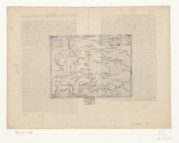
This is Frans Hogenberg's "Kaart van Zeeland," a map of Zeeland created around the late 16th century. Hogenberg lived during a time of significant political and religious upheaval in the Netherlands, including the Dutch Revolt against Spanish rule. This context shapes how we might view his work; maps like this were not just geographical tools, but instruments of power, identity, and control. Consider the emotional weight of such an image for those living through conflict, displacement, and the redrawing of borders. Zeeland, as depicted, becomes more than land, it is a symbol of home, of a nation struggling for self-determination. Hogenberg's map provides a glimpse into how places become intertwined with identity, reflecting both a collective sense of belonging and the individual experiences of those who called this region home. By focusing on the particularities of Zeeland, Hogenberg’s map highlights the intimate relationship between people and place, a relationship forged in times of peace and tested in the crucible of war.
Comments
No comments
Be the first to comment and join the conversation on the ultimate creative platform.
More like this