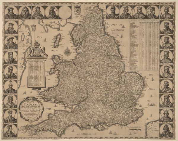
drawing, print, etching, paper
#
drawing
# print
#
etching
#
landscape
#
paper
#
coloured pencil
Dimensions: height 175 mm, width 262 mm
Copyright: Rijks Museum: Open Domain
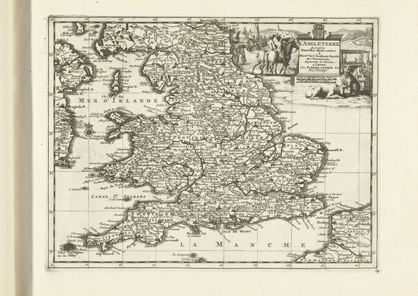
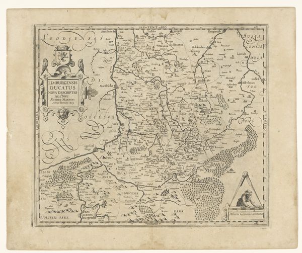
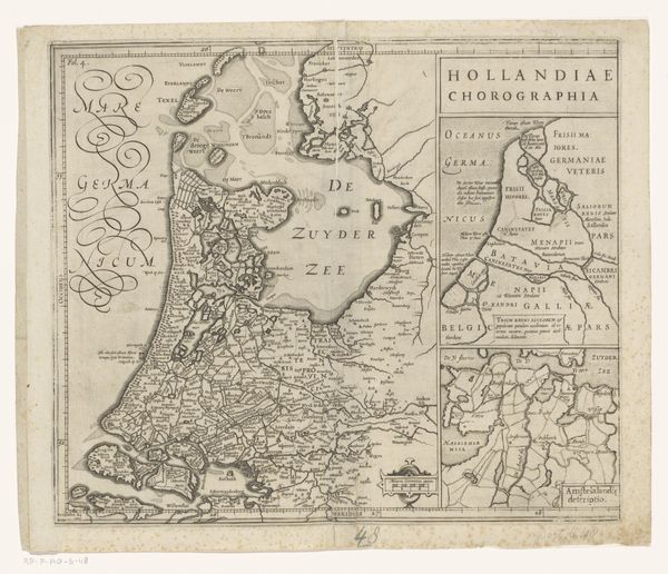
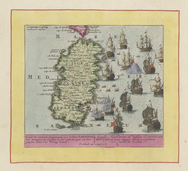
Curator: Here we have a piece entitled “Kaart van Engeland,” or "Map of England," made in 1734 by Jan van Jagen, using drawing, print, and etching techniques on paper. What are your initial impressions? Editor: It feels both precise and dreamlike, a blend I adore. The gentle washes of color make it feel like a half-remembered land, even though it's attempting accuracy. There's a strangeness to seeing familiar borders rendered with such deliberate quaintness. Curator: It's fascinating to consider maps as cultural artifacts, isn't it? More than just guides, they’re these little power statements, literally defining territories. Think of the Dutch Golden Age, which coincides with van Jagen's period. Cartography exploded. It was essential to trade and asserting national identity, even dominance. Editor: Oh, absolutely! I get a sense of almost a proprietorial gaze—a confident assertion of knowledge and possession. Those flowing, almost decorative, coastlines strike me as attempts at beauty, a wish to almost caress the land they are capturing. Curator: That's insightful. The Dutch, with their vast seafaring networks, were actively shaping and reshaping their world—economically, politically, and visually. A map like this fed directly into that expansionist energy, bolstering that sense of mastery. The color adds a layer of imagined reality. How much of this was directly informed by surveys, and how much was political imagination? Editor: I also sense a very palpable fragility to this representation. This is, after all, an etching on paper. Maps present these absolute perspectives, but the delicate materiality is so obviously open to damage. I wonder how they envisioned it living in the world – whether these objects felt precious. Curator: An excellent point! I think objects like this have an incredibly complicated life—part practical tool, part aspirational symbol. I'm particularly drawn to the areas where the ink seems to bleed or where the lines aren't perfectly clean. Those 'mistakes' pull me in. They become evidence of a human hand. It breaks down the fiction of complete control a map often implies. Editor: The imperfections do humanize it, make it more relatable. The washes, for example, could also be read as stains, as marks of age. What might have seemed an objective presentation slowly reveals itself as deeply personal. Curator: Ultimately, seeing "Kaart van Engeland," alongside all it represents, I find myself drawn to the tension between what’s recorded fact and what's imaginative projection. Editor: For me, the act of observing transforms the original intent again. The way light catches on this antique page and renders what were once proclamations of authority and mastery back into uncertain wonder... that makes it something vital, really.
Comments
No comments
Be the first to comment and join the conversation on the ultimate creative platform.
More like this