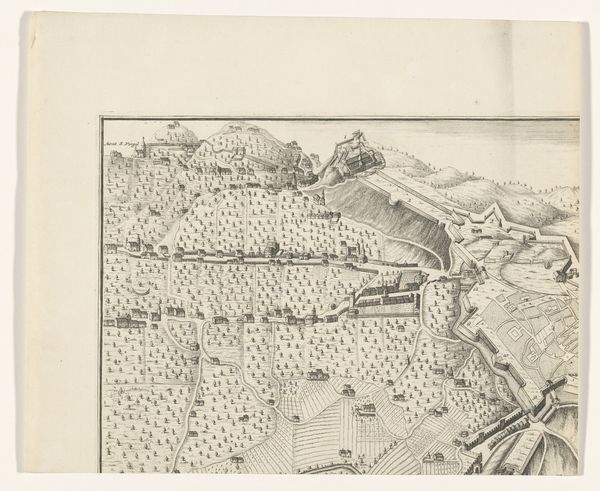
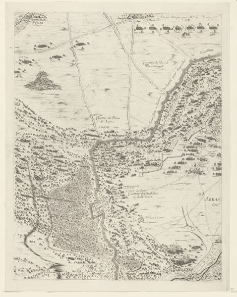
Plattegrond van fort Oostenburgh en een kaart van het gebied tussen Batticaloa en Trincomalee 1726
0:00
0:00
jacobkeyser
Rijksmuseum
print, engraving
#
baroque
# print
#
asian-art
#
old engraving style
#
landscape
#
linocut print
#
geometric
#
cityscape
#
engraving
Dimensions: height 317 mm, width 196 mm
Copyright: Rijks Museum: Open Domain
Curator: Good morning. We are standing before "Plattegrond van fort Oostenburgh en een kaart van het gebied tussen Batticaloa en Trincomalee," or "Plan of Fort Oostenburgh and a Map of the Area between Batticaloa and Trincomalee". This engraving, created by Jacob Keyser in 1726, offers a fascinating glimpse into the Dutch East India Company's cartographic efforts in Sri Lanka. Editor: It feels so… precise. Rigid, almost. The geometric forms of the fort contrast so starkly with the seemingly endless rows of meticulously etched trees. It is an intriguing balance. Curator: Precisely. Observe how the lines articulate space, particularly in delineating the boundaries of Fort Oostenburgh against the landscape and in representing depth on the map. The use of engraving allows for remarkable clarity. Editor: The materiality here is really striking. We see the engraver mediating colonial power through technical skill; the fort itself becomes a commodity, reproducible on paper and distributed for strategic purposes. Consider the physical labor involved in such detailed work. It humanizes the sterile geometry. Curator: The composition echoes elements found within Baroque landscapes and cityscapes. There is a distinct formalism. Each element, meticulously placed, functions to create an overall sense of order and authority. Editor: Right, but how can we divorce the aesthetic from the economic impetus that fueled such detail? These weren't artistic renderings. They were tools—created through resource extraction and serving a very real, very exploitative colonial project. Curator: Indeed. Yet, the formal elegance offers another lens through which we understand the period's aesthetic values and approach to documenting, appropriating, and ordering the world through observation and representation. Editor: It’s hard not to see these lines as drawing literal borders. We are seeing this space controlled and reconfigured on paper, as its resources are also extracted for capital. I feel its aesthetic impact must be seen in relation to that. Curator: A powerful interpretation that brings historical context into sharp focus with artistic skill and rendering, illuminating those connections to provide critical insight into the era. Editor: Absolutely. I found this deep-dive helpful. A welcome perspective on a complex period and the artifacts it produced.
Comments
No comments
Be the first to comment and join the conversation on the ultimate creative platform.
More like this