drawing, paper, ink
#
drawing
#
aged paper
#
toned paper
#
baroque
#
old engraving style
#
landscape
#
paper
#
personal sketchbook
#
ink
#
ink drawing experimentation
#
geometric
#
pen-ink sketch
#
pen work
#
sketchbook drawing
#
storyboard and sketchbook work
#
sketchbook art
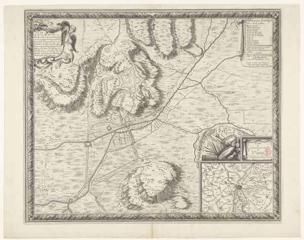
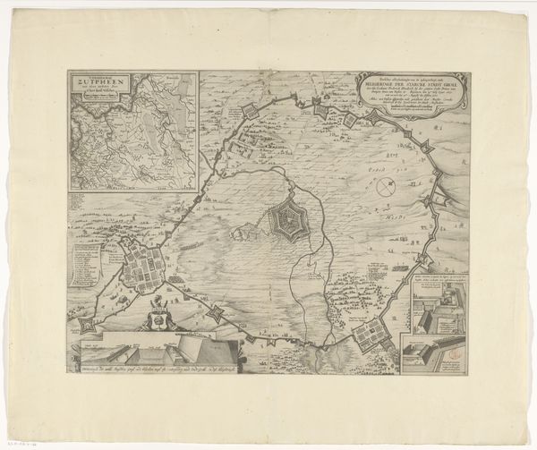
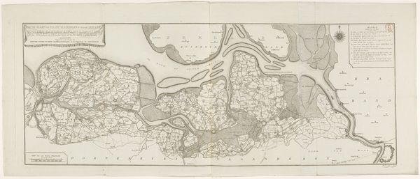
Dimensions: height 390 mm, width 531 mm
Copyright: Rijks Museum: Open Domain
This map of Saint-Venant was made by an anonymous artist, using ink on paper. The fine lines describe the city and surrounding landscape, from rivers to fields to buildings. Consider the skill involved in creating such a detailed rendering, and also the social context in which this skill was deployed. Cartography was not just a matter of technical expertise, but also power. Maps like this were tools of governance, allowing rulers to survey and control territory. The paper itself, though seemingly humble, represents a complex chain of production, from the harvesting of raw materials to the labor of papermaking and printing. Look closely, and you can imagine the human effort embedded in every stage of its creation. It's a reminder that even seemingly objective representations of the world are shaped by human hands and social forces.
Comments
No comments
Be the first to comment and join the conversation on the ultimate creative platform.
More like this