About this artwork
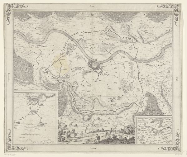
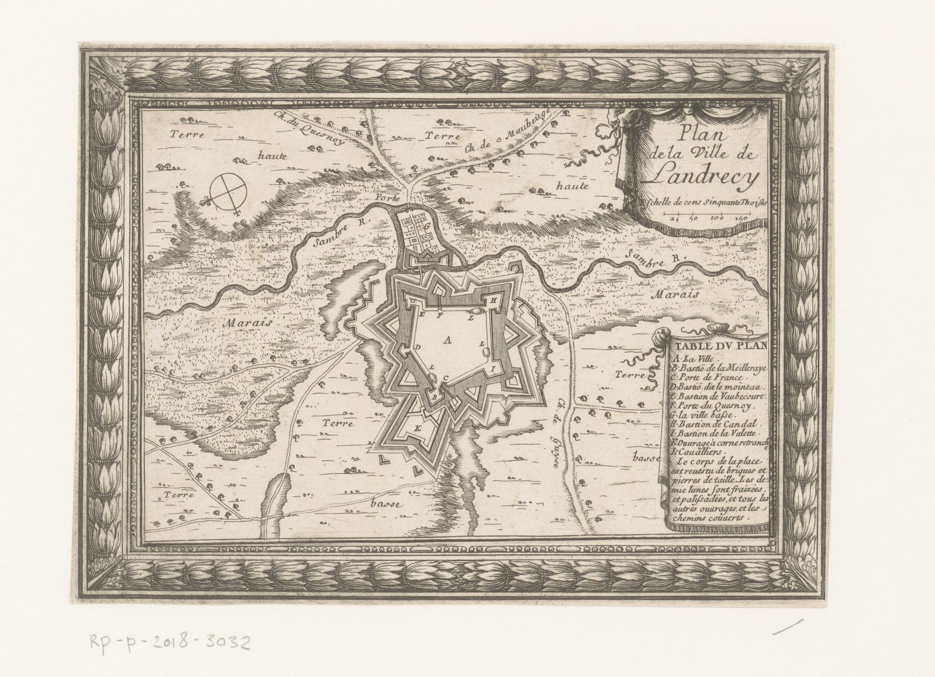
Curator: Let's turn our attention to this striking piece, "Plattegrond van Landeschie," an engraving, dating sometime between 1700 and 1729. It resides at the Rijksmuseum. Editor: My immediate thought is how meticulously rendered everything is, and with such precision. I feel the cold calculation of strategy. There is this overwhelming sense of controlled space in this piece. Curator: Indeed, as an engraving, we can appreciate the labor involved in creating these fine lines. It's fascinating to consider the socio-economic aspects. Prints made images widely accessible; imagine the consumption patterns, how this depiction of Landeschie might have shaped the understanding of geography. How did ordinary people think about city planning in 18th century in Holland? Editor: And it's not merely about access, it's also about control. Star-shaped fortresses became prominent in Europe. Landeschie at the time, and other fortress cities symbolized power through symbolic architecture – like some modern cities today. You see those perfect geometric shapes which represented more than simply physical defenses but also projected visual ideas of control, like the all-seeing eye. What thoughts are invoked as you, standing in our modern shoes, analyze the landscape of Landeschie? Curator: From a materialist perspective, I am also intrigued by the geographic information itself, in relation to power. Note the specific emphasis on navigable waterways. The access of trade, moving materials, how roads create channels of command, which are emphasized materially here with ink, tools, and engraving know-how. Editor: Yes, there's something very striking about the interplay between nature and culture—or perhaps better, nature versus culture as portrayed. Those fields beyond the city’s walls feel like "uncontrolled territory" full of the unexpected, a foil for all geometric designs we see in the city itself, no? Even the frame around the image echoes this rigid sense of order. Curator: Absolutely. This exploration also reveals how the engraver utilized specialized tools to create such uniform depth and clarity, speaking to an artisan's material skill but also shaping viewers perception and dissemination of that geographical understanding. The artist becomes a material conveyor of spatial power through that engraving process. Editor: This "Plattegrond van Landeschie," although unsigned, leaves us plenty to explore through its detailed symbolism, its intricate making, and its layered emotional power across eras. Curator: I concur. Thinking about what that craft of city representation meant socio-economically deepens our awareness of both the artisan's process, that image’s context, and what remains potent today.
Artwork details
- Medium
- print, engraving
- Dimensions
- height 136 mm, width 185 mm
- Location
- Rijksmuseum
- Copyright
- Rijks Museum: Open Domain
Tags
landscape
geometric
cityscape
engraving
Comments
No comments
About this artwork
Curator: Let's turn our attention to this striking piece, "Plattegrond van Landeschie," an engraving, dating sometime between 1700 and 1729. It resides at the Rijksmuseum. Editor: My immediate thought is how meticulously rendered everything is, and with such precision. I feel the cold calculation of strategy. There is this overwhelming sense of controlled space in this piece. Curator: Indeed, as an engraving, we can appreciate the labor involved in creating these fine lines. It's fascinating to consider the socio-economic aspects. Prints made images widely accessible; imagine the consumption patterns, how this depiction of Landeschie might have shaped the understanding of geography. How did ordinary people think about city planning in 18th century in Holland? Editor: And it's not merely about access, it's also about control. Star-shaped fortresses became prominent in Europe. Landeschie at the time, and other fortress cities symbolized power through symbolic architecture – like some modern cities today. You see those perfect geometric shapes which represented more than simply physical defenses but also projected visual ideas of control, like the all-seeing eye. What thoughts are invoked as you, standing in our modern shoes, analyze the landscape of Landeschie? Curator: From a materialist perspective, I am also intrigued by the geographic information itself, in relation to power. Note the specific emphasis on navigable waterways. The access of trade, moving materials, how roads create channels of command, which are emphasized materially here with ink, tools, and engraving know-how. Editor: Yes, there's something very striking about the interplay between nature and culture—or perhaps better, nature versus culture as portrayed. Those fields beyond the city’s walls feel like "uncontrolled territory" full of the unexpected, a foil for all geometric designs we see in the city itself, no? Even the frame around the image echoes this rigid sense of order. Curator: Absolutely. This exploration also reveals how the engraver utilized specialized tools to create such uniform depth and clarity, speaking to an artisan's material skill but also shaping viewers perception and dissemination of that geographical understanding. The artist becomes a material conveyor of spatial power through that engraving process. Editor: This "Plattegrond van Landeschie," although unsigned, leaves us plenty to explore through its detailed symbolism, its intricate making, and its layered emotional power across eras. Curator: I concur. Thinking about what that craft of city representation meant socio-economically deepens our awareness of both the artisan's process, that image’s context, and what remains potent today.
Comments
No comments