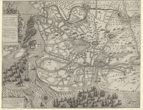
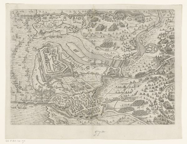
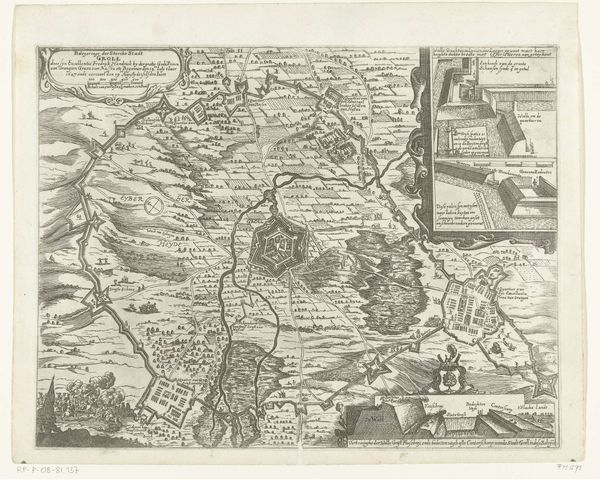
Schansen bij het beleg van Bergen op Zoom in 1622 en de schansen aan de Schelde in 1627 1649 - 1651
anonymous
Rijksmuseum
drawing, print, ink, engraving
drawing
baroque
dutch-golden-age
landscape
ink
geometric
engraving
Dimensions: height 294 mm, width 366 mm
Copyright: Rijks Museum: Open Domain
This detailed map, made by an anonymous artist, depicts the siege of Bergen op Zoom in 1622 and the fortifications along the Schelde River in 1627. It's created using engraving, a printmaking technique where lines are incised into a metal plate, which then holds ink for printing. The engraver would have used specialized tools to carefully carve the intricate details of the landscape, fortifications, and text. The material qualities of the metal plate itself influence the character of the lines, their precision, and the overall texture of the print. Think of the labor involved in producing such a work. The engraver had to be both technically skilled and deeply knowledgeable about cartography and military strategy. Beyond its aesthetic value, the print served a crucial function, communicating vital information about territorial control and military campaigns. The act of producing and distributing prints like these was tied to the politics of the time. Looking closely at the lines and the way they define space allows us to appreciate the intersection of craft, knowledge, and power inherent in this work.
Comments
No comments
Be the first to comment and join the conversation on the ultimate creative platform.