print, etching
# print
#
etching
#
landscape
#
geometric
#
history-painting
Dimensions: height 159 mm, width 231 mm
Copyright: Rijks Museum: Open Domain
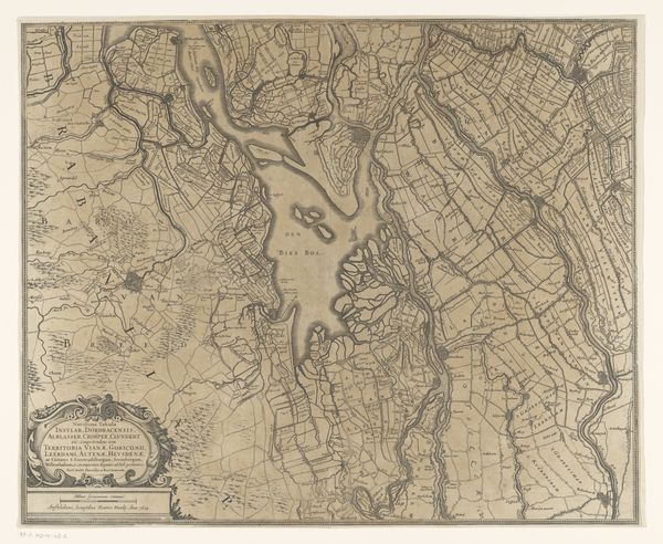
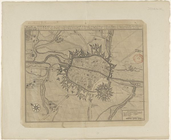
Editor: This etching, "Kaart van de Baronie van Breda," dating roughly from 1635 to 1696, and created by an anonymous artist, shows an early map. What jumps out at me is how this representation blends the practical with a certain symbolic grandeur. How do you interpret the symbolic language used here? Curator: Precisely! This isn’t just geography; it’s a statement. The "Kaart" visualizes power through its specific visual language. Note how "BREDA" is centered. Maps were, and still are, cultural artifacts, reflecting not just physical space, but the desires and ideologies of their creators and intended audiences. The linear boundaries of farmland contrast sharply with organic river formations; even these natural elements seem brought under control. What emotions does this sense of order evoke? Editor: It does create a feeling of... mastery, of a deliberate structuring of the world. But also, something feels slightly ominous in such strict control. Is this perhaps a reminder of power and dominion? Curator: Exactly. Symbols embedded in this image carry immense psychological and cultural weight. The meticulous lines evoke a sense of ownership, control, even surveillance. It also highlights our innate need to classify and organise our surrounding environment. What historical associations might these types of displays of power trigger in viewers from different eras? Editor: Thinking about it that way, it transforms the map from a simple guide into something far more loaded with meaning. It shows how a society perceives itself and its relationship to the land. Curator: Indeed! The emotional resonance of maps goes beyond practical navigation. They are potent cultural symbols, shaping our perceptions of belonging and power. We are reminded that visual elements act as lasting vehicles for both intentional messages and complex interpretations across generations.
Comments
No comments
Be the first to comment and join the conversation on the ultimate creative platform.
More like this