About this artwork
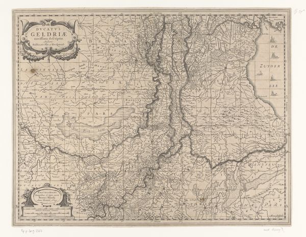
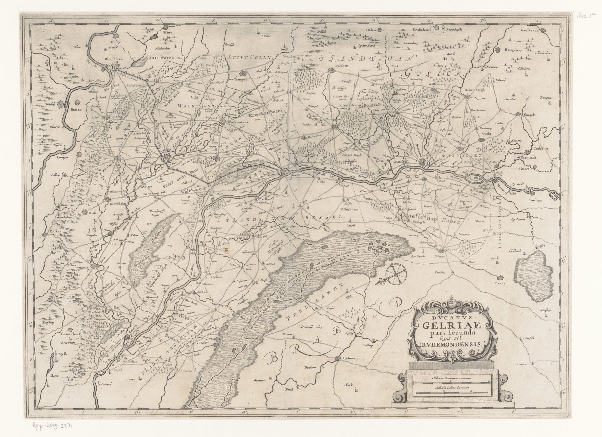
Curator: Here we have an intriguing map, “Kaart van het Overkwartier van Gelre,” an engraving that offers a bird's-eye perspective of a portion of the historical Duchy of Guelders. It dates from around 1644-1680 and is held at the Rijksmuseum. Editor: It looks incredibly precise, yet somehow fragile. The lines are so fine. I wonder about the paper itself – what it was like when new, what processes of making contributed to the aesthetic that we're viewing today. Curator: Indeed. The materials would have been meticulously prepared, reflecting the importance of cartography in asserting political and economic power. And if we look closely, we see symbolic elements: small illustrations of buildings to mark cities, perhaps gesturing toward their prominence. Editor: Yes, these aren’t merely geographic renderings; these are representations of authority. Think about the skill needed to transfer knowledge onto copper or a similar material. Who trained them and were their tools common for their period? The labor really shifts my perspective. Curator: The creation of such maps also reflected a specific worldview, mapping not only physical space, but also the perceived order of the world. Notice how dominant the river is. It creates a linear structure through the territories represented here, evoking trade and strategic access. Editor: Water is so key for resources, right? The rivers connect things while serving as a border; power and practicality exist at the same time. Did the commissioners or rulers want the people of their territory to view their surroundings in this exact, visually unifying way? Curator: Absolutely. Maps served as instruments of control. Their circulation created a shared, yet controlled understanding of geographical and political space among different groups. What seems merely informative is loaded with power. Editor: Precisely. Considering the material, and its distribution: did it affect land ownership? Trade routes? Or even the simple navigation practices of everyday lives at all societal levels? The ripple effect is fascinating. Curator: It's a powerful lens through which to see history and the relationship between material culture and psychological landscape. Editor: By analyzing the material execution, it enhances how the work existed in the Dutch Golden Age, a unique time where people interacted and functioned. It shows how maps became, more than their apparent intentions, things.
Artwork details
- Medium
- graphic-art, print, engraving
- Dimensions
- height 386 mm, width 520 mm
- Location
- Rijksmuseum
- Copyright
- Rijks Museum: Open Domain
Tags
Comments
Share your thoughts
About this artwork
Curator: Here we have an intriguing map, “Kaart van het Overkwartier van Gelre,” an engraving that offers a bird's-eye perspective of a portion of the historical Duchy of Guelders. It dates from around 1644-1680 and is held at the Rijksmuseum. Editor: It looks incredibly precise, yet somehow fragile. The lines are so fine. I wonder about the paper itself – what it was like when new, what processes of making contributed to the aesthetic that we're viewing today. Curator: Indeed. The materials would have been meticulously prepared, reflecting the importance of cartography in asserting political and economic power. And if we look closely, we see symbolic elements: small illustrations of buildings to mark cities, perhaps gesturing toward their prominence. Editor: Yes, these aren’t merely geographic renderings; these are representations of authority. Think about the skill needed to transfer knowledge onto copper or a similar material. Who trained them and were their tools common for their period? The labor really shifts my perspective. Curator: The creation of such maps also reflected a specific worldview, mapping not only physical space, but also the perceived order of the world. Notice how dominant the river is. It creates a linear structure through the territories represented here, evoking trade and strategic access. Editor: Water is so key for resources, right? The rivers connect things while serving as a border; power and practicality exist at the same time. Did the commissioners or rulers want the people of their territory to view their surroundings in this exact, visually unifying way? Curator: Absolutely. Maps served as instruments of control. Their circulation created a shared, yet controlled understanding of geographical and political space among different groups. What seems merely informative is loaded with power. Editor: Precisely. Considering the material, and its distribution: did it affect land ownership? Trade routes? Or even the simple navigation practices of everyday lives at all societal levels? The ripple effect is fascinating. Curator: It's a powerful lens through which to see history and the relationship between material culture and psychological landscape. Editor: By analyzing the material execution, it enhances how the work existed in the Dutch Golden Age, a unique time where people interacted and functioned. It shows how maps became, more than their apparent intentions, things.
Comments
Share your thoughts