print, etching, engraving
#
dutch-golden-age
# print
#
etching
#
old engraving style
#
landscape
#
etching
#
engraving
Dimensions: height 316 mm, width 400 mm
Copyright: Rijks Museum: Open Domain
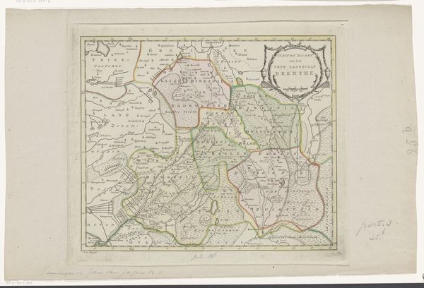
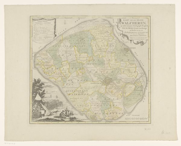
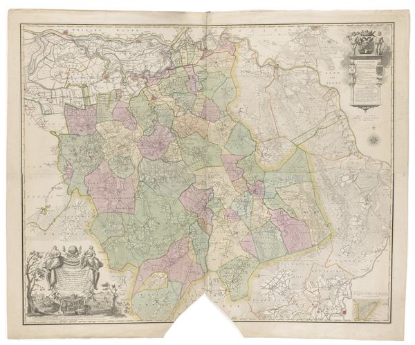
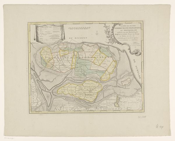
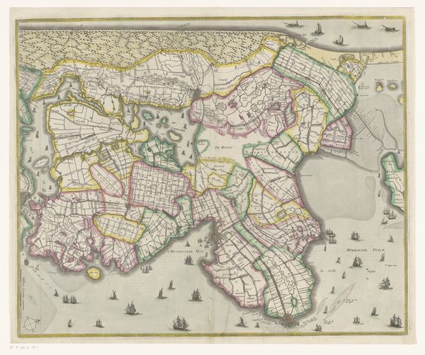
Curator: Ah, I love old maps! This one's entitled "Kaart van het eiland Tholen," or "Map of the Island of Tholen," created sometime between 1753 and 1760 by an anonymous artist. It’s an engraving and etching, a beautiful example of Dutch Golden Age cartography, and comes to us from the Rijksmuseum collection. Editor: Well, the colours are quite muted, but somehow comforting. I am getting a very calm vibe, if I am honest; it evokes a sense of distance and, perhaps paradoxically, of gentle stewardship over the land depicted. Curator: The soft colors, though likely faded with time, still speak to the region's identity. Consider, Tholen's geographic position at the time! Situated amidst waterways, it held strategic importance. Maps like these weren’t just about navigation; they were assertions of power, showing who controlled what, defining territories. Editor: True. Thinking about what that kind of controlled delineation would have felt like is interesting, against, say, today’s constantly shifting globalized perception of space. But back to aesthetics for a moment – it is hard not to notice that decorative cartouche! Curator: That cartouche! Almost an artwork in itself, isn't it? Serving to legitimise and underscore the importance of the depicted territory, reinforcing social and political constructs. Editor: Exactly! One really gets the sense of how vital these geographical surveys must have been – that knowing every village and inlet mattered a great deal. Curator: Absolutely. And to be clear: Tholen itself, still a distinct municipality in the Netherlands today. This map provides tangible historical evidence. These intricate maps played such an active role in administration and land management. Editor: Maps are powerful things; they can alter what they delineate! Thinking about that old expression ‘here be dragons' – even their perceived neutrality serves some implicit goal. Well, thank you for those fascinating details. It’s been delightful. Curator: My pleasure! Delving into cartography, for me, is a joy. You come away with the sensation that you've stepped back into a rich history and lived the daily experience of someone centuries before.
Comments
No comments
Be the first to comment and join the conversation on the ultimate creative platform.
More like this