graphic-art, print, etching
#
graphic-art
#
dutch-golden-age
# print
#
etching
#
landscape
#
etching
Dimensions: height 434 mm, width 536 mm
Copyright: Rijks Museum: Open Domain
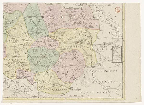
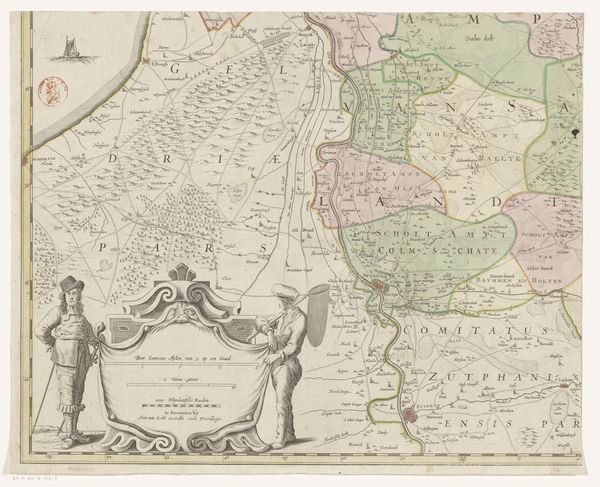
This is a section of Gerard Coeck’s map of Overijssel, made in the mid-17th century using ink and watercolor on paper. The character of this map is profoundly influenced by its materiality. Thin washes of color delineate political boundaries, transforming this slice of Overijssel into a patchwork of territories. These decisions weren’t purely aesthetic. Mapmaking in this period was a painstaking process, requiring a labor-intensive combination of surveying, drafting, and engraving. The tools included compasses, rulers, and specialized pens for fine linework. The creation of such maps also had social and cultural significance. They were tools of governance and commerce, visualizing territorial claims and trade routes. They were also symbols of power, demonstrating a society’s capacity to understand and control its environment. So, next time you look at a map, remember the skilled hands and complex processes that shaped it, and the deep connections between materials, making, and meaning.
Comments
No comments
Be the first to comment and join the conversation on the ultimate creative platform.
More like this