print, etching
baroque
etching
landscape
etching
Dimensions: height 464 mm, width 544 mm
Copyright: Rijks Museum: Open Domain
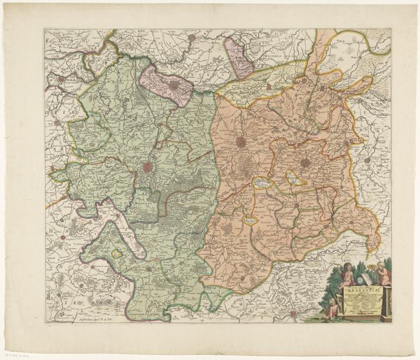
Curator: Let's spend a moment contemplating this remarkable "Kaart van het noordwestelijk deel van Brabant," created sometime between 1633 and 1696 by an anonymous hand. It's a print, an etching, currently held in the Rijksmuseum. Editor: Immediately, I'm struck by the tension here. This isn't just geography; it’s about power and perspective. The careful detail suggests a desire for control, to delineate and, therefore, perhaps, to claim. Curator: Exactly. Maps in this era were powerful tools of statecraft. This image served a very practical function. How does seeing Brabant visually laid out impact your thinking about the artwork's socio-political implications? Editor: It's impossible to ignore how mapping served as an arm of colonial power. This etching normalizes the idea of territories neatly defined and easily surveyed, which conveniently facilitated control and resource extraction. Think of the impact on the indigenous communities living there. Curator: Good point. Looking at it from that angle, one recognizes this isn't simply an objective record, but a particular visual construction loaded with ideological baggage. Notice, however, the Baroque flourishes – the embellishments at the lower right. What function did these decorations serve? Editor: These embellishments create a kind of symbolic branding, embedding the authority of Brabant within a framework of visual allegory. The allegorical figures and cartouche serve as subtle propaganda, solidifying a sense of legitimacy through beauty and order. And the choice of colours... were those intended to convey meaning as well? Curator: Colour application on prints from this period frequently had symbolic weight, whether that be claims to power, economic signalling, or statements of territory. Consider that the artist has emphasized certain regions in order to call attention to strategic geographical assets. Editor: It's truly compelling to consider it as more than just a historical document, but a deliberate cultural and political construction. It’s a perfect lens to examine the intertwining of knowledge, power, and representation. Curator: Yes, this detailed map provides an amazing avenue for considering issues such as ownership, authority, and ways that power dynamics manifest in art. Editor: Absolutely. I'm leaving with so many questions about the visual language being used, the hands shaping it, and those who were omitted.
Comments
No comments
Be the first to comment and join the conversation on the ultimate creative platform.