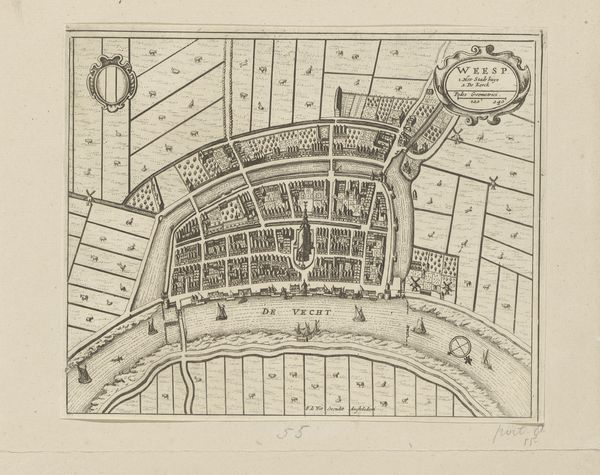
graphic-art, print, etching, engraving
graphic-art
dutch-golden-age
etching
etching
cityscape
engraving
Dimensions: height 462 mm, width 568 mm
Copyright: Rijks Museum: Open Domain
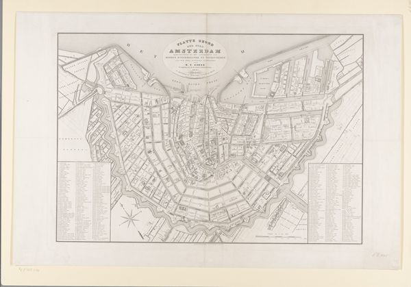
Editor: So, this is "Plattegrond van Amsterdam" by Daniël (II) Veelwaard, created in 1832. It’s an etching and engraving, offering a detailed map of the city. What strikes me is the almost obsessive level of detail and the way Amsterdam seems completely contained within its fortifications. What can you tell me about it? Curator: That sense of containment is key. Consider this: maps in the 19th century were rarely neutral. They functioned as assertions of power and control. The meticulous detail you noticed, the very act of mapping, served to legitimize Amsterdam's civic authority. How do you think this image participated in constructing a specific identity for Amsterdam, both for its inhabitants and for outsiders? Editor: That's interesting! I hadn't considered the power dynamics. It’s like the map is saying, “We know every inch, we control it all." Does the way it's displayed, in the Rijksmuseum, influence its meaning today? Curator: Absolutely. Placing this map within a museum context elevates it. It’s no longer purely functional but becomes a historical artifact, prompting reflection on urban development and societal changes. Who gets to decide which version of the city’s story is told and displayed? That decision carries significant political weight, don't you think? Editor: Definitely! And looking closer, it shows not just the physical layout but also hints at economic and social activity through the docks and street plans. I now see the map as more than just geographical data; it’s a cultural statement. Curator: Precisely! It's a window into the values and priorities of the society that created and consumed it. Analyzing these historical maps reveals much about how urban space was understood and utilized, and who benefited most from that arrangement. Editor: That's a whole new perspective for me. I never thought a map could be so…loaded! Thanks for pointing that out.
Comments
No comments
Be the first to comment and join the conversation on the ultimate creative platform.