About this artwork
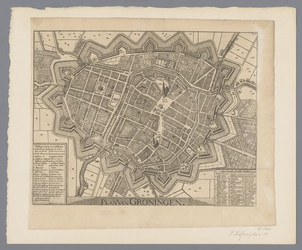
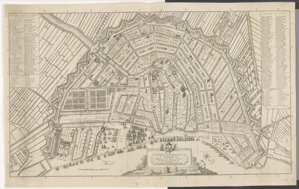
Daniël Veelwaard's "Plattegrond van Amsterdam," presents us with a detailed map, a symbolic representation of order and control. Here, the star, traditionally a symbol of guidance, is refigured not to navigate the seas, but to orient the city itself. The act of mapping itself is a primal desire to understand and command our surroundings. This impulse can be traced back to antiquity with maps etched onto clay tablets, each reflecting a culture's desire to chart its world. This echoes in the modern-day, as we continually map new territories. The map becomes a canvas for our collective memories and a symbol of our ambition to structure the chaos of existence. The very act of creating a map engages with the human psyche, and it transforms into a form of collective memory.
Artwork details
- Medium
- print, etching
- Dimensions
- height 545 mm, width 790 mm
- Location
- Rijksmuseum
- Copyright
- Rijks Museum: Open Domain
Tags
etching
etching
geometric
cityscape
Comments
No comments
About this artwork
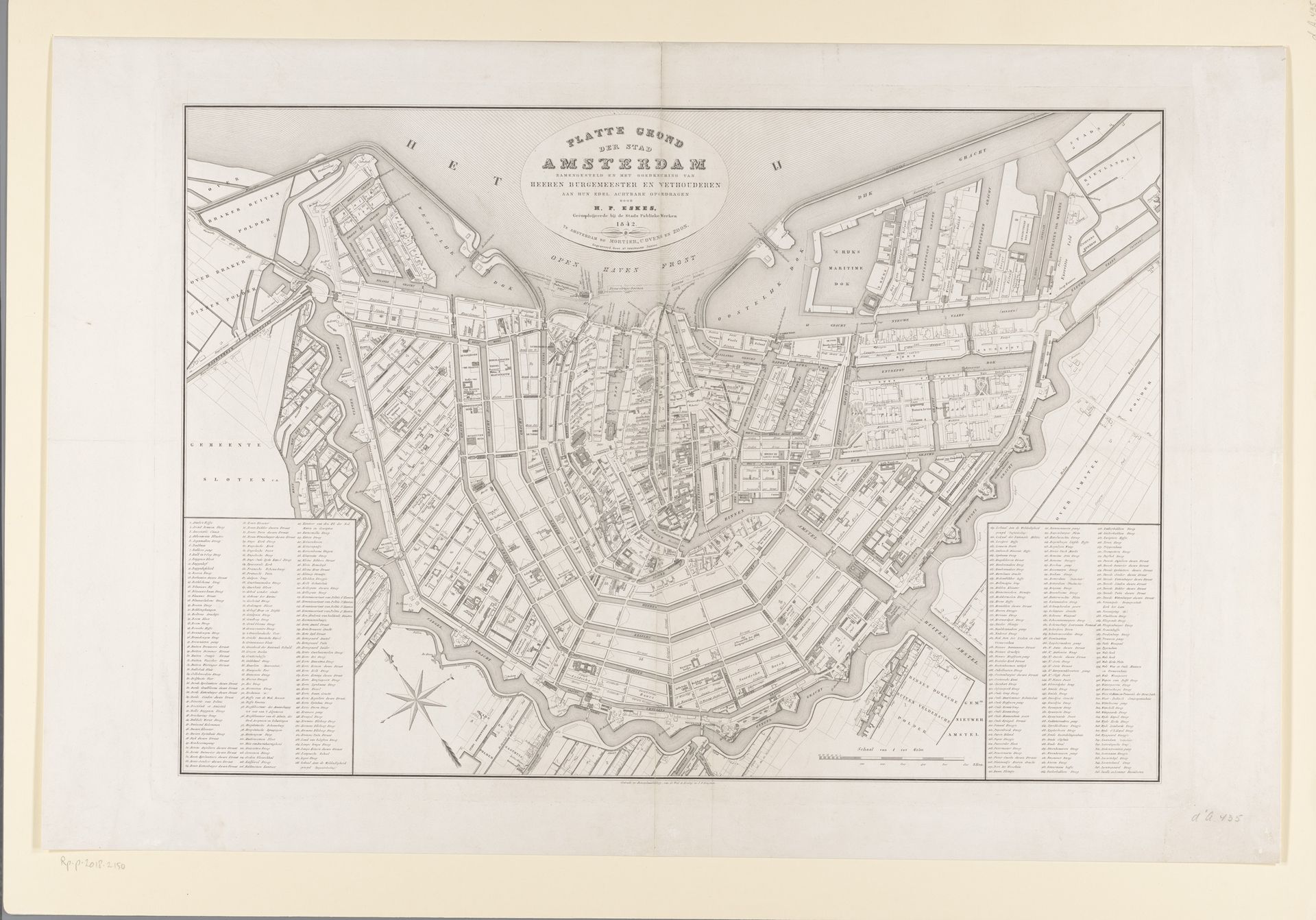
Daniël Veelwaard's "Plattegrond van Amsterdam," presents us with a detailed map, a symbolic representation of order and control. Here, the star, traditionally a symbol of guidance, is refigured not to navigate the seas, but to orient the city itself. The act of mapping itself is a primal desire to understand and command our surroundings. This impulse can be traced back to antiquity with maps etched onto clay tablets, each reflecting a culture's desire to chart its world. This echoes in the modern-day, as we continually map new territories. The map becomes a canvas for our collective memories and a symbol of our ambition to structure the chaos of existence. The very act of creating a map engages with the human psyche, and it transforms into a form of collective memory.
Comments
No comments