print, engraving
dutch-golden-age
cityscape
engraving
Dimensions: height 390 mm, width 502 mm
Copyright: Rijks Museum: Open Domain
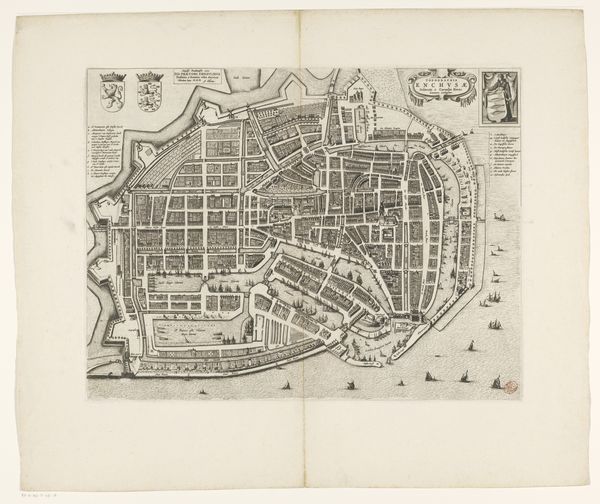
This is an anonymous, undated map of Enkhuizen, rendered with ink on paper. A striking feature of this plan is the tension between organic and geometric forms, as seen through its winding streets versus rigidly organised districts. Notice the top left, where the lines of the outer fortification meet the grid-like structures within. The linear precision used to depict this division of space hints at power structures defining the physical and social layout of the city. The cartographer's hand, guided by the needs of representation, creates a symbolic language that speaks to the control and administration of urban space. Look at how the map combines empirical observation with symbolic representation, revealing a deeper cultural and intellectual framework. This is a historical document which also functions as a complex cultural artifact.
Comments
No comments
Be the first to comment and join the conversation on the ultimate creative platform.