print, engraving
#
baroque
# print
#
line
#
cityscape
#
engraving
Dimensions: height 235 mm, width 322 mm
Copyright: Rijks Museum: Open Domain
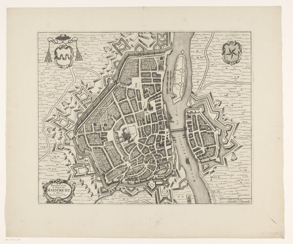
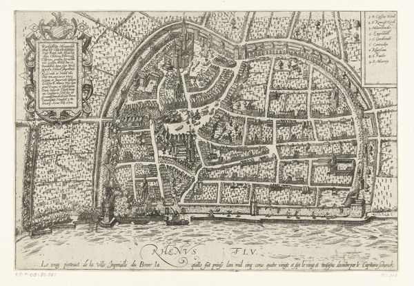
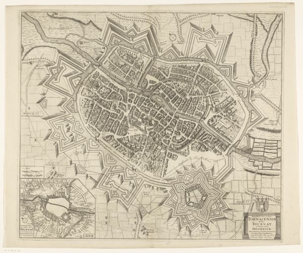
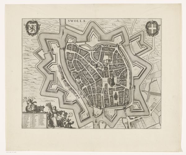
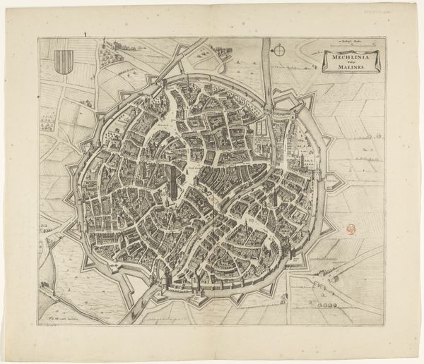
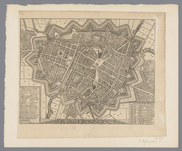
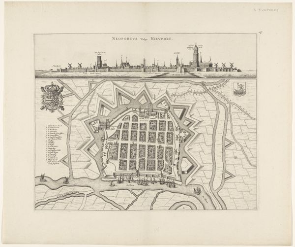
This is an anonymous print of Regensburg, made at an unknown date using etching. It gives us a bird's-eye view of the city, complete with its fortifications and key buildings. As an art historian, I’m interested in how images like this were used to assert power. This map isn't just a neutral depiction of Regensburg; it's a statement about control and knowledge. In the early modern period, maps were vital tools for rulers and merchants alike, providing strategic insights into territories and trade routes. Notice how the fortifications are emphasized, highlighting the city’s defenses. The detailed rendering of buildings also suggests a deep understanding of Regensburg’s layout and resources. To truly understand this print, we'd need to delve into the history of cartography and urban planning in the Holy Roman Empire. What was Regensburg’s role within the broader political landscape? How did its fortifications reflect contemporary military strategies? By examining archival documents, we can uncover the social and institutional context that shaped the creation and reception of this image. The meaning of art is contingent on its context.
Comments
No comments
Be the first to comment and join the conversation on the ultimate creative platform.
More like this