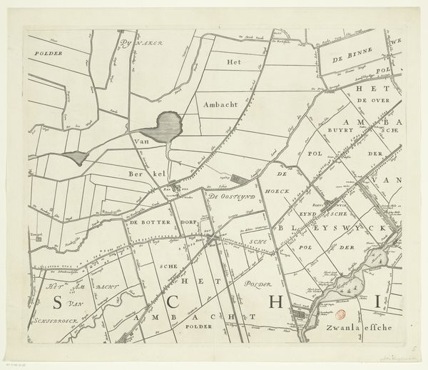
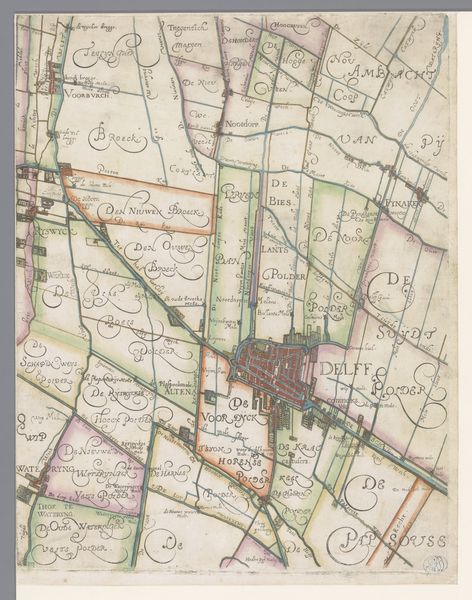
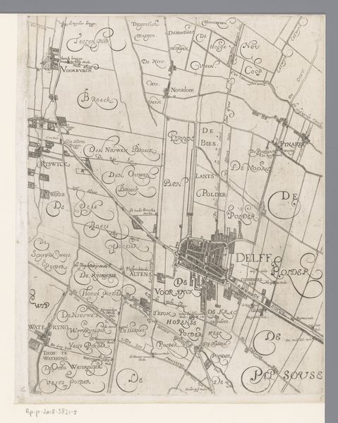
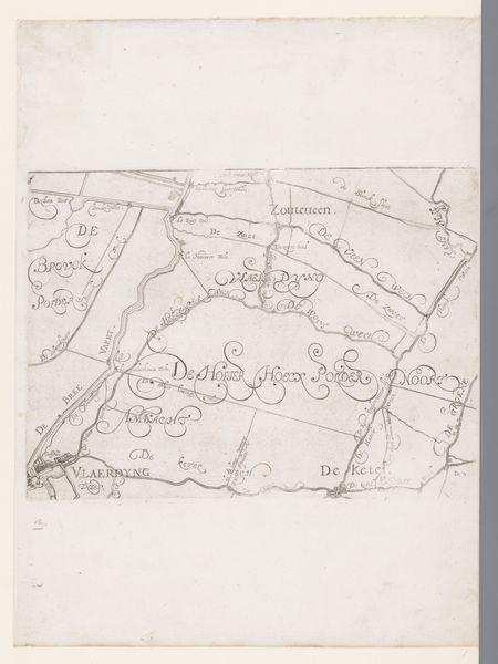
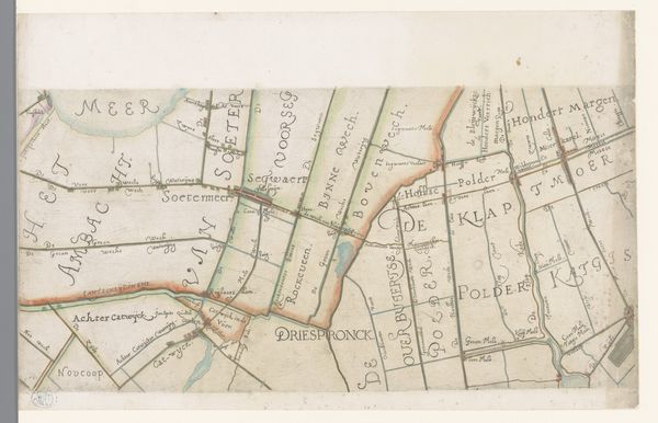
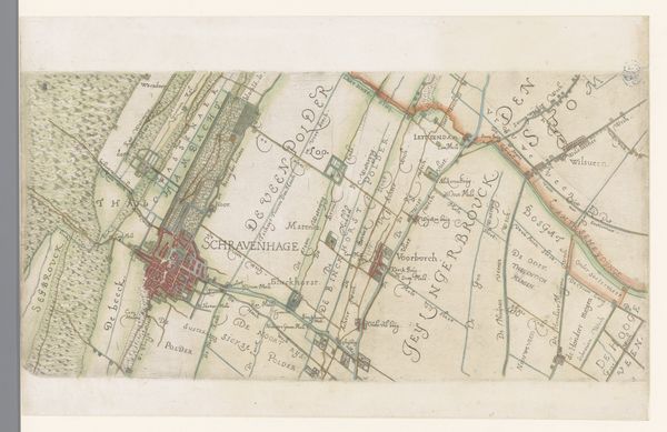
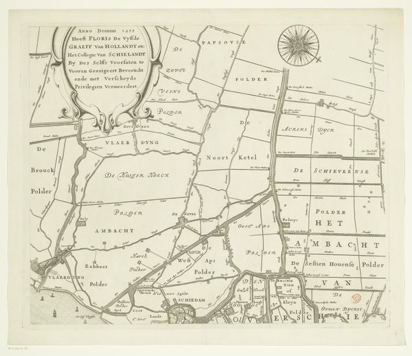
Kaart van het Hoogheemraadschap van Delfland, met Den haag, Delft en Berkel en Rodenrijs, middelste deel 1611 - 1692
florisbalthasarszvanberckenrode
Rijksmuseum
drawing, print, etching, paper, ink
drawing
dutch-golden-age
etching
incomplete sketchy
hand drawn type
landscape
paper
personal sketchbook
ink
ink drawing experimentation
hand drawn
geometric
pen-ink sketch
pen work
sketchbook drawing
cityscape
hand-drawn
sketchbook art
Dimensions: height 379 mm, width 905 mm
Copyright: Rijks Museum: Open Domain
Curator: Before us, we have "Kaart van het Hoogheemraadschap van Delfland, met Den Haag, Delft en Berkel en Rodenrijs, middelste deel," an intriguing map created sometime between 1611 and 1692 by Floris Balthasarsz van Berckenrode. It’s currently held in the collection of the Rijksmuseum. Editor: Immediately, I'm struck by the almost textile quality of the thing! The lines, meticulously etched, create a landscape that feels simultaneously precise and almost ornamental. Curator: It's fascinating how the artist combines cartographic accuracy with a clear aesthetic sensibility. Note the geometric forms, rendered with etching and ink on paper. The linear precision emphasizes the structural composition. The layout gives form to the human impact of dividing and administering land. Editor: Absolutely. I'm especially interested in the materials themselves. Think of the labour involved in creating these maps, reproducing them and using them for land management and agriculture. The craft that went into the etching process and the materiality of the paper; these all speak volumes about Dutch Golden Age material culture and economics. Curator: And within the lines and shapes, there's a compelling contrast between the defined areas and open spaces. The meticulous labeling lends a certain balance but notice how areas of denser habitation contrast areas left unmentioned? There’s something structurally eloquent about it, creating a dialogue between what is included and omitted. Editor: That leads me to wonder who were the intended viewers of this map and for what purpose? These would've been landowners, civic administrators, wealthy people shaping their immediate surroundings, surely, making land productive to fuel their wealth. This map reflects the labouring landscape being shaped by human hands and enterprise. Curator: I agree. Reflecting on the complete form, the work transcends mere documentation; it offers an aestheticized perspective on societal control, on that era's scientific precision. It invites consideration not just of the "what" but of the "how" and "why". Editor: And to me, that 'how' leads right to 'who' paid for it. That process of both exploitation and creation embedded in every line, a testament to the power dynamics shaping the Dutch landscape at that moment. Curator: Indeed. An intricate artifact to reflect on both its function and artistry. Editor: Precisely, art serving a very earthly, practical purpose, made beautiful by careful human action and intervention.
Comments
No comments
Be the first to comment and join the conversation on the ultimate creative platform.