drawing, graphic-art, paper, ink
#
drawing
#
graphic-art
#
landscape
#
paper
#
ink
#
geometric
#
line
#
realism
Dimensions: height 204 mm, width 291 mm
Copyright: Rijks Museum: Open Domain
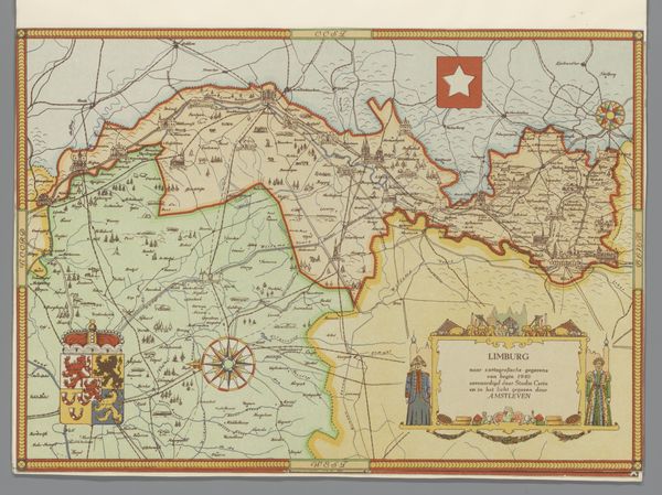
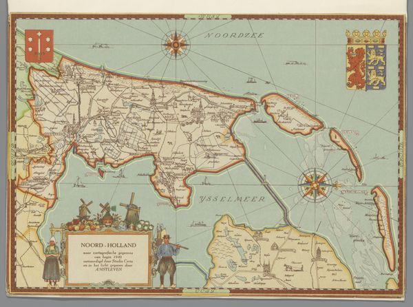
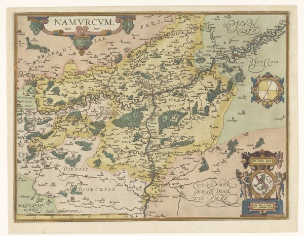
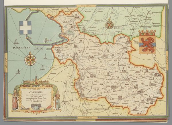
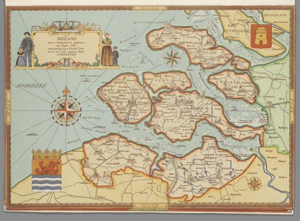
Curator: At first glance, it feels very much like an atlas illustration or perhaps a study for a history textbook. It's compelling. Editor: Indeed. What we have here is a graphic work by Studio Certo, “Kaart van Noord-Brabant, 1940,” or "Map of North Brabant, 1940." Executed circa 1947, it’s a detailed rendering in ink on paper. The color is subdued but deliberate. Curator: Subdued yet those symbols practically vibrate with meaning! The compass rose at the center…the coat of arms flanking the margins… These aren't mere decorations, are they? They telegraph something about power and place, a certain historical gravity. Editor: Absolutely. Maps have always been more than simple geographic tools; they are cultural documents reflecting sociopolitical contexts. The very act of mapping is an act of claiming and defining territory. A question to consider, then, is what did Noord-Brabant represent in 1940? This was a painful period under German occupation in the Netherlands during WWII. This map, while ostensibly about location, is really a visual encoding of wartime identity and experience. Curator: That's astute. It highlights how maps often participate in shaping national consciousness. I’m intrigued by how the artist combines meticulous detail with overtly symbolic imagery—heraldry with very geometric, real style. I want to know how its original viewers would read the space. It serves to establish the region. To remind, or to console? Editor: Precisely. Even the choice to depict it after the war ends—to reflect on that fixed moment in 1940—it turns geography into memory. Studio Certo offers a layered depiction; an image, really, meant for those navigating not just the physical landscape, but the layered socio-political one. Curator: This artwork is fascinating because it prompts consideration of our perception and treatment of these geographic visual tools that also function as ideological representations. We look at a region as fixed by lines and ink, when its true existence rests upon historical complexity, even conflict and war. Editor: This artwork prompts consideration of not only the lines that visually define spaces, but about how they continue to speak to both identity and even continuity.
Comments
No comments
Be the first to comment and join the conversation on the ultimate creative platform.
More like this