drawing, print, paper, ink
#
drawing
# print
#
landscape
#
paper
#
11_renaissance
#
ink
#
geometric
#
cityscape
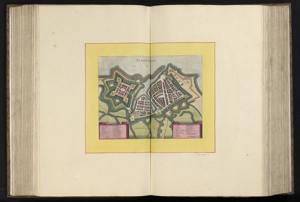
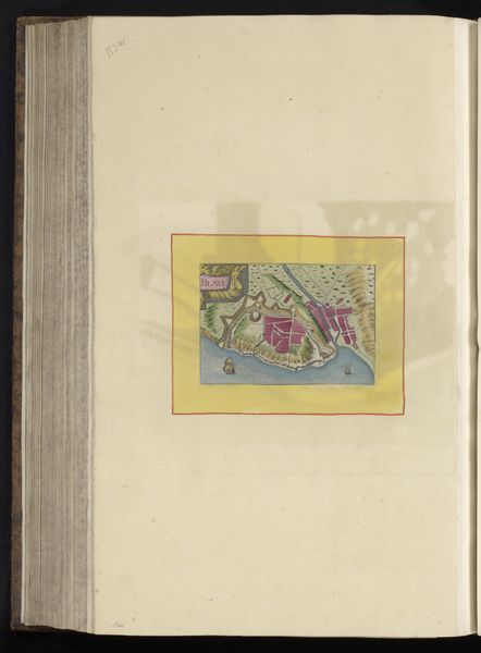
Dimensions: height 103 mm, width 150 mm, height 532 mm, width 320 mm
Copyright: Rijks Museum: Open Domain
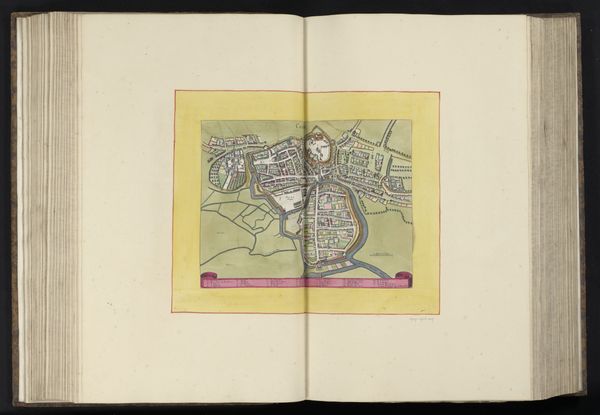
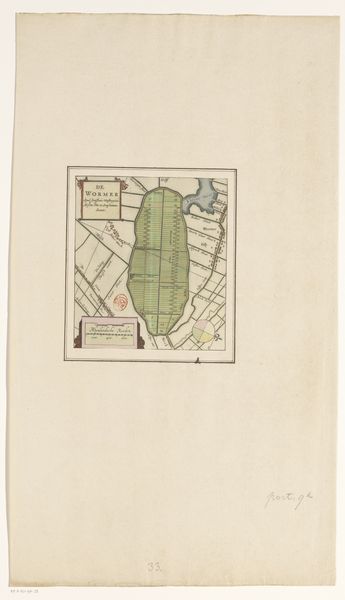
Curator: This intriguing ink and paper print, dating back to 1638, is entitled "Plattegrond van Château-Renard". Editor: Immediately, the rosy hues of the imagined terrain grab me—it's as if we are looking at the very veins and arteries that make this Château-Renard pulse. Curator: The visual choices are definitely striking. We are presented with what seems like an architectural plan, yet rendered with the aesthetic sensibilities of a landscape. The geometric shapes starkly contrast with the more naturalistic representation of land, questioning our perceived notions of space. Editor: Absolutely! The use of colour seems more symbolic than realistic, prompting a deeper consideration of how the inhabitants of Château-Renard wanted to perceive their relationship with the land. Was the goal purely cartographic or did they mean to express a desire for dominion? Curator: Given the historical context, there's a solid case for that. During this period, landscape prints played an important public role by celebrating specific places and the dominion that wealthy owners held over them. By controlling visual access to these majestic views or estate maps, the elites strengthened their societal position. Editor: It makes you consider the politics of display. What’s included and excluded in this portrayal speaks volumes. We get glimpses of meticulously organised land but we also lack specifics: people are absent and there’s no acknowledgment of marginal groups in this community. Who is the intended viewer of this idyllic scene? Curator: The very clean execution reinforces the intent of controlling how the place is perceived. It reminds me of other contemporary examples from the 17th century, intended to idealize a controlled and orderly society, even in times of conflict and uncertainty. Editor: Reflecting on it, it’s difficult not to impose present-day perspectives on historical art, even a cityscape like this one. But acknowledging its existence through today’s understanding is equally crucial for allowing conversations around power dynamics to emerge, and to hopefully, inspire us to question them. Curator: I agree completely; thinking of how spaces, even those imagined or idealised like this one, function as reflections of prevailing ideologies helps us become more conscious citizens in our own spaces.
Comments
No comments
Be the first to comment and join the conversation on the ultimate creative platform.
More like this