drawing, paper, watercolor
#
drawing
#
paper
#
watercolor
#
cityscape
#
watercolor
Dimensions: height 208 mm, width 271 mm, height 532 mm, width 320 mm
Copyright: Rijks Museum: Open Domain
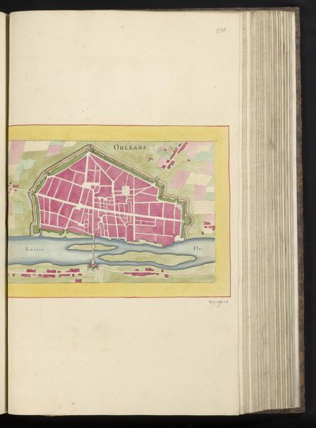
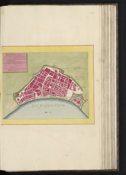
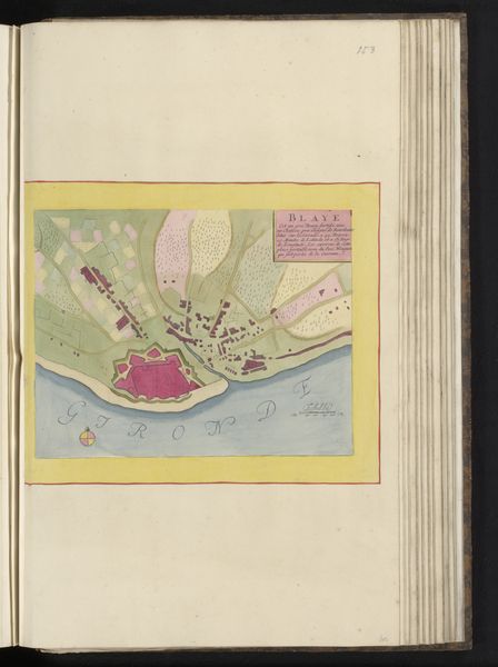
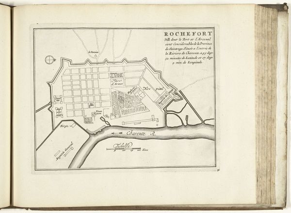
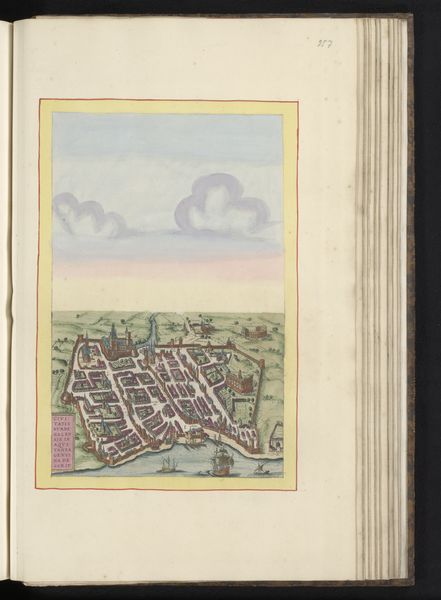
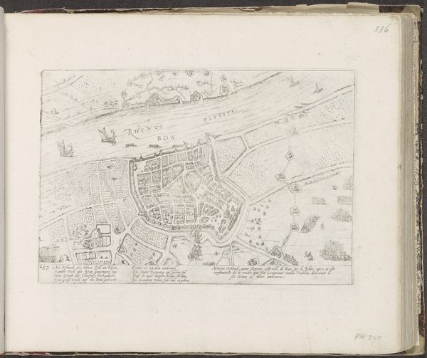
Curator: Here at the Rijksmuseum, we have an intriguing drawing entitled “Plattegrond van Rochefort,” or “Map of Rochefort,” made around 1690 to 1700. It is an anonymous work created with watercolor on paper. Editor: Well, the first thing that jumps out at me is this delightful, almost childish charm. It’s got this simple palette and a straightforward presentation that reminds me of the maps I used to draw of my imaginary kingdoms as a kid. Curator: It's fascinating to think about these early maps as powerful tools, you know, beyond just directions. Mapping a city was about claiming it, understanding its strategic vulnerabilities, controlling its resources. The grid layout speaks volumes about imposing order and governance. Editor: Order, yes, but it also speaks of the arrogance of imposing a geometric will upon a landscape that surely had its own story long before. Still, there’s a tenderness in the hand that colored this map, a loving depiction. Those carefully rendered waterways! You can almost feel the city breathing. Curator: Absolutely, the waterways were vital. Rochefort was a crucial naval arsenal, and this map would have been essential for planning its defense, infrastructure, and expansion. Consider who commissioned this: likely the French military or urban planners, central figures in shaping not only the physical space of the city, but its societal role. Editor: Shaped by power, visualized with art... the way even seemingly objective documentation always reflects the person behind the pen, or, in this case, the brush. Looking closer, it is as if this rendering brings to life not just stone and water, but something far more... something of that very moment. Curator: Indeed. Examining "Plattegrond van Rochefort," we are presented not only with a visual document but with a record reflecting political intent and historical understanding. Editor: Maps are never neutral territories; instead, they echo with our whispers. And just like memories, these artworks only live for as long as someone speaks of them.
Comments
No comments
Be the first to comment and join the conversation on the ultimate creative platform.
More like this