painting, watercolor
#
baroque
#
dutch-golden-age
#
painting
#
landscape
#
watercolor
#
cityscape
#
watercolor
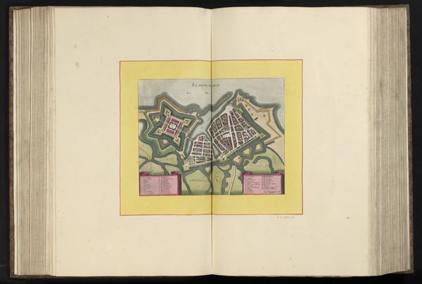
Dimensions: height 194 mm, width 272 mm, height 532 mm, width 318 mm
Copyright: Rijks Museum: Open Domain
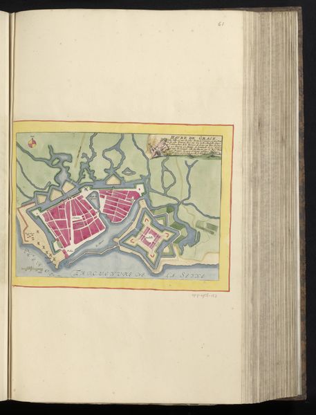
Editor: This watercolor, "Plattegrond van Calais en directe omgeving," created around 1690-1695 by Harmanus van Loon, presents a detailed plan of Calais. It's so precise; it feels almost like peering through a historical spyglass. What speaks to you most profoundly when you examine this map? Curator: The map speaks to me of power and control, rendered through symbolic cartography. The intricate fortifications aren’t merely geographical features; they’re potent symbols of a city’s defenses, its ambitions, and anxieties in a tumultuous era. Do you notice the repeated geometric patterns used to depict the bastions? Editor: I do see the geometric patterns. They feel almost like a stylized, fortified mandala. Curator: Precisely! Consider that even the colors used might carry coded messages. The red, perhaps denoting areas of strategic importance or even…bloodshed? How might the intended audience in the 17th century have interpreted this careful articulation of space? Editor: I hadn’t considered color symbolism so directly. So the visual language extends beyond mere representation and communicates anxieties related to conflict? Curator: Exactly. Even today, these symbols trigger associations: fortified places evoke memories of past conflicts, resilience, and vigilance. The map acts as a cultural memory capsule. Editor: Thinking about it that way, the map is more than just ink and watercolor; it's a coded story of a city's historical consciousness. Thanks! Curator: And you've started to see how our interpretation becomes another layer added to the artifact, echoing across time. Fascinating!
Comments
No comments
Be the first to comment and join the conversation on the ultimate creative platform.
More like this