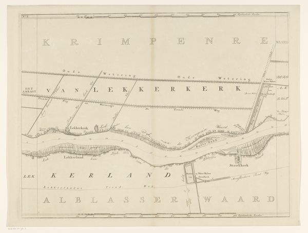
Deel van een kaart van het Hoogheemraadschap van Rijnland, met Gouda en omgeving 1615
0:00
0:00
florisbalthasarszvanberckenrode
Rijksmuseum
drawing, print, paper
#
drawing
#
dutch-golden-age
# print
#
landscape
#
paper
#
geometric
Dimensions: height 230 mm, width 477 mm
Copyright: Rijks Museum: Open Domain
Curator: Let’s examine "Deel van een kaart van het Hoogheemraadschap van Rijnland, met Gouda en omgeving," a drawing and print on paper created around 1615 by Floris Balthasarsz van Berckenrode. Its location is Gouda and its environment. Editor: What strikes me immediately is the dominance of geometric shapes, the clean lines defining territories and waterways. It’s all about structure, the formal organization of space. Curator: Precisely. And beyond the aesthetic, think of the physical labor embedded in land surveying, drafting, and the subsequent printing process that made this information accessible. Each line represents human effort to shape and define the land. Editor: Indeed. The choice of colors, too—the muted greens and browns—reinforces the rational organization. They emphasize clarity and legibility over expressive gesture. Curator: Although muted, these colors do have to be obtained somehow, either through a local source or, more than likely, trade with outside communities for pigments. Also, the materiality of the paper itself tells a story. Where did this come from, and what level of processing was needed? The value would impact the production of the artwork itself. Editor: It speaks to a specific purpose beyond mere representation, correct? It represents authority. Curator: The Hoogheemraadschap was indeed responsible for water management and regional administration. I'm also taken by the cartographer's choice to include names. Editor: Van Berckenrode gives each defined area a name, making this piece about the land itself as much as those who inhabit the land. Curator: The names of cities like Gouda. It certainly served as a tool for governance and control. I find that contrast in functionality very striking. Editor: From my point of view, I recognize the artistic representation for a specific, very practical task: that task is region planning. Editor: From mine, this reminds me of a functional geometric project—as a blueprint made available to the city’s council. Curator: Perhaps next time we will look at other pieces by van Berckenrode.
Comments
No comments
Be the first to comment and join the conversation on the ultimate creative platform.
More like this