About this artwork
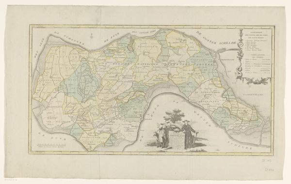
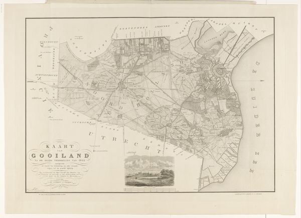
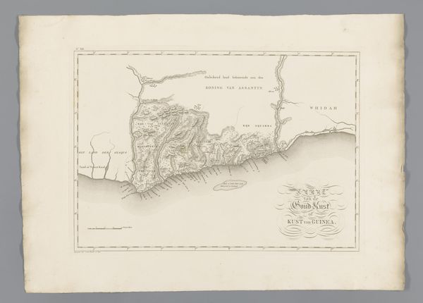
Editor: So, this is a map titled "Kaart van een deel van Zeeuws-Vlaanderen," created in 1867. It looks like it was made with etching and ink on paper. I'm immediately struck by how detailed it is; it's almost overwhelming to take it all in. What can you tell me about it? Curator: Maps, beyond their utilitarian function, are potent cultural artifacts. How do you think this map, produced in 1867, participated in shaping perceptions, control, or even the idea of Zeeuws-Vlaanderen? Was it made for military planning, land ownership, or simply to bolster civic pride? Editor: I suppose it could be used for any of those purposes. How would a map from this time reflect political power? Curator: In the 19th century, mapmaking was often tied to national identity and colonial ambitions. The very act of mapping a territory asserted control and knowledge. Look closely: What’s included, what’s omitted? Scale, legend, font choices—all are decisions that encode the mapmaker's perspective, reflecting their relationship to the place being depicted. Editor: I notice the detailed division of land, possibly plots for ownership? The emphasis is less on elevation and more on defining boundaries. Curator: Precisely! It serves as a record, a declaration of order, but also invites us to consider who benefits from this structured view. Maps like this, meticulously detailing land ownership and administrative divisions, played a critical role in shaping social and economic structures. Whose perspective does it represent, and whose is silenced? Editor: It makes me think about how 'objective' things like maps can actually reinforce power structures. I never considered that before. Curator: Exactly! Now you see how art, even in its most functional forms, always speaks volumes about the society that creates it. Thanks for helping me consider what is absent but could have been made visible.
Artwork details
- Medium
- print, etching, paper, ink
- Dimensions
- height 661 mm, width 960 mm
- Copyright
- Rijks Museum: Open Domain
Tags
etching
landscape
etching
paper
ink
Comments
No comments
About this artwork
Editor: So, this is a map titled "Kaart van een deel van Zeeuws-Vlaanderen," created in 1867. It looks like it was made with etching and ink on paper. I'm immediately struck by how detailed it is; it's almost overwhelming to take it all in. What can you tell me about it? Curator: Maps, beyond their utilitarian function, are potent cultural artifacts. How do you think this map, produced in 1867, participated in shaping perceptions, control, or even the idea of Zeeuws-Vlaanderen? Was it made for military planning, land ownership, or simply to bolster civic pride? Editor: I suppose it could be used for any of those purposes. How would a map from this time reflect political power? Curator: In the 19th century, mapmaking was often tied to national identity and colonial ambitions. The very act of mapping a territory asserted control and knowledge. Look closely: What’s included, what’s omitted? Scale, legend, font choices—all are decisions that encode the mapmaker's perspective, reflecting their relationship to the place being depicted. Editor: I notice the detailed division of land, possibly plots for ownership? The emphasis is less on elevation and more on defining boundaries. Curator: Precisely! It serves as a record, a declaration of order, but also invites us to consider who benefits from this structured view. Maps like this, meticulously detailing land ownership and administrative divisions, played a critical role in shaping social and economic structures. Whose perspective does it represent, and whose is silenced? Editor: It makes me think about how 'objective' things like maps can actually reinforce power structures. I never considered that before. Curator: Exactly! Now you see how art, even in its most functional forms, always speaks volumes about the society that creates it. Thanks for helping me consider what is absent but could have been made visible.
Comments
No comments