About this artwork
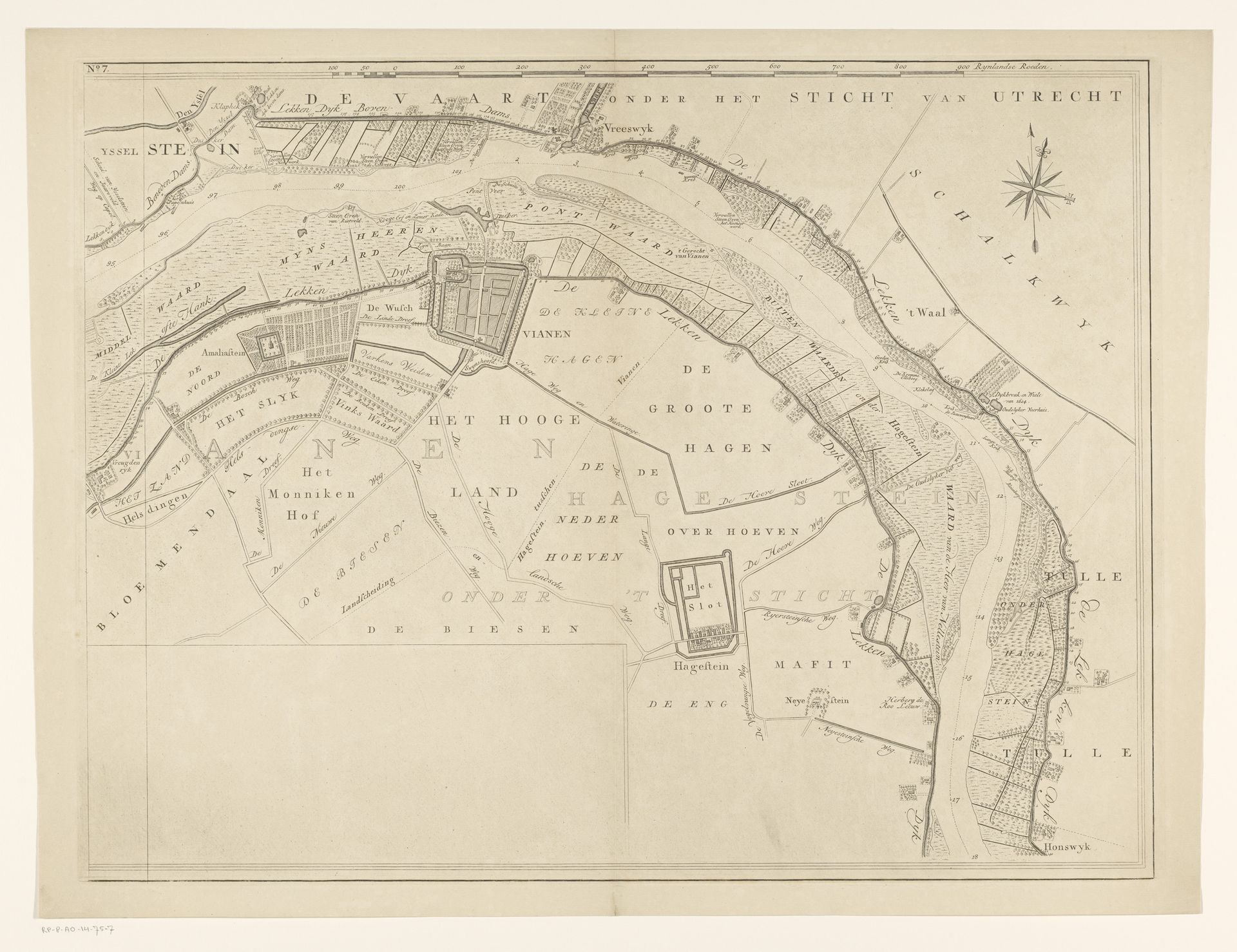
Editor: Here we have "Kaart van de rivier de Lek (zevende deel)," or "Map of the Lek River (seventh part)," an engraving from 1764-1765 by Isaak Tirion. It feels very precise and technical, almost like an architectural plan rather than something artistic. How would you interpret this work? Curator: It's tempting to see it only as a functional document, but these maps were far from neutral. Consider that this "Kaart" wasn't just charting geography. It was visually asserting Dutch power and control over vital waterways. These maps were commissioned, shaped by political needs. Editor: So the act of mapping itself was a political statement? Curator: Precisely! Who gets to define and depict territory, and how, holds immense power. Look at the detailed depictions of settlements along the river - what do they communicate about the value placed on those settlements? Notice any distinctions in how different areas are represented? Editor: I see some areas look more built-up, and others appear mostly rural. I guess that shows which regions were considered more economically or strategically important. So the map isn’t just reflecting reality; it's actively constructing a specific version of it. Curator: Exactly. This kind of cartography supported trade ambitions and territorial claims. It served as a tool of governance. Understanding its social context is essential to truly see it. What have you learned looking closely at this piece? Editor: I realize that even something that seems objective can be deeply embedded in its historical context. Curator: And how institutions like the government shaped its creation and purpose! A whole new perspective!
Kaart van de rivier de Lek (zevende deel)
1764 - 1765
Isaak Tirion
1705 - 1765Location
RijksmuseumArtwork details
- Medium
- print, engraving
- Dimensions
- height 500 mm, width 657 mm
- Location
- Rijksmuseum
- Copyright
- Rijks Museum: Open Domain
Tags
Comments
Share your thoughts
About this artwork
Editor: Here we have "Kaart van de rivier de Lek (zevende deel)," or "Map of the Lek River (seventh part)," an engraving from 1764-1765 by Isaak Tirion. It feels very precise and technical, almost like an architectural plan rather than something artistic. How would you interpret this work? Curator: It's tempting to see it only as a functional document, but these maps were far from neutral. Consider that this "Kaart" wasn't just charting geography. It was visually asserting Dutch power and control over vital waterways. These maps were commissioned, shaped by political needs. Editor: So the act of mapping itself was a political statement? Curator: Precisely! Who gets to define and depict territory, and how, holds immense power. Look at the detailed depictions of settlements along the river - what do they communicate about the value placed on those settlements? Notice any distinctions in how different areas are represented? Editor: I see some areas look more built-up, and others appear mostly rural. I guess that shows which regions were considered more economically or strategically important. So the map isn’t just reflecting reality; it's actively constructing a specific version of it. Curator: Exactly. This kind of cartography supported trade ambitions and territorial claims. It served as a tool of governance. Understanding its social context is essential to truly see it. What have you learned looking closely at this piece? Editor: I realize that even something that seems objective can be deeply embedded in its historical context. Curator: And how institutions like the government shaped its creation and purpose! A whole new perspective!
Comments
Share your thoughts