graphic-art, print, engraving
#
graphic-art
#
baroque
# print
#
landscape
#
geometric
#
engraving
Dimensions: height 204 mm, width 272 mm
Copyright: Rijks Museum: Open Domain
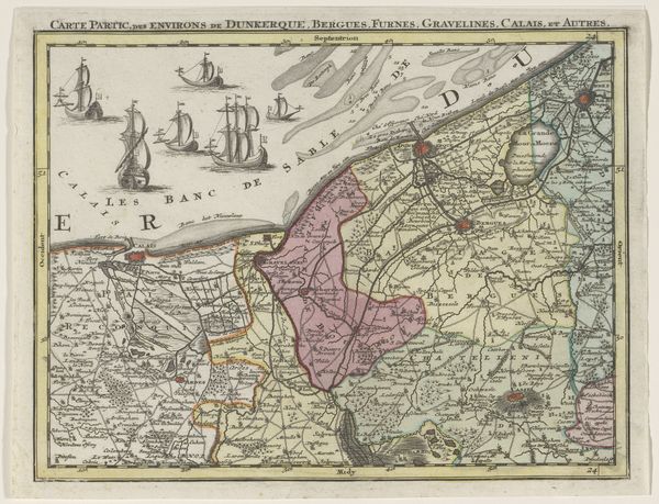
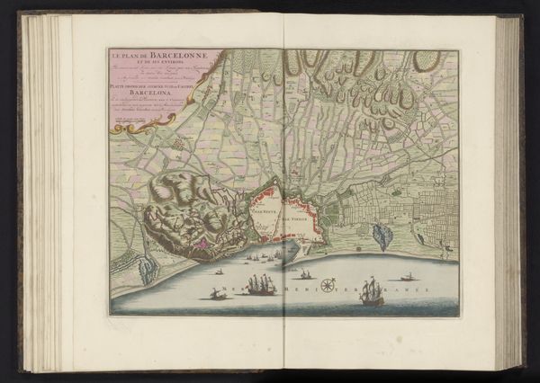
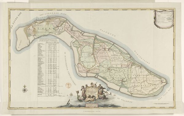
Tobias Conrad Lotter rendered this section of the Austrian Netherlands as an engraving around the mid-18th century. Dominating the composition are the ships, sailing vessels that signify trade, exploration, and the projection of power across the seas. These ships are more than mere transport; they are potent symbols deeply rooted in our collective psyche. In ancient iconography, ships were often associated with journeys of the soul, ferrying the dead to the afterlife. Think of the Viking ship burials or the Egyptian solar barques navigating the underworld. This cartographic representation of ships shows how they have evolved. From ancient symbols of death and rebirth to emblems of commerce and colonial expansion. The emotional resonance of maritime travel remains potent, evoking feelings of adventure but also the precariousness of human existence. The allure and the peril of the sea speak to something primal within us, a subconscious acknowledgement of our fragile place in the world. Such images of maritime power persist, ever-changing, yet eternally tied to the depths of our cultural memory.
Comments
No comments
Be the first to comment and join the conversation on the ultimate creative platform.
More like this