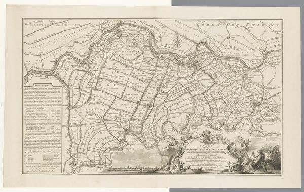
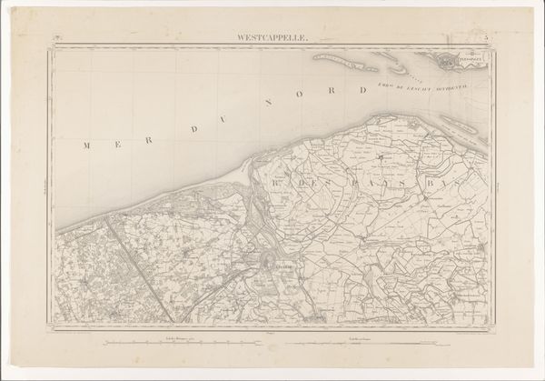
Kaart van de Sloterbinnen- en Middelveldse gecombineerde polders, 1675 1702 - 1726
0:00
0:00
anonymous
Rijksmuseum
print, etching, engraving
#
dutch-golden-age
# print
#
etching
#
landscape
#
etching
#
engraving
Dimensions: height 500 mm, width 711 mm
Copyright: Rijks Museum: Open Domain
Editor: Here we have an etched map entitled "Kaart van de Sloterbinnen- en Middelveldse gecombineerde polders, 1675" made sometime between 1702 and 1726 by an anonymous artist. It is currently held in the Rijksmuseum collection. It strikes me how meticulously detailed it is, every field and waterway precisely rendered. What do you make of this print, considered from a formalist perspective? Curator: The strength of this piece lies within the network of lines themselves. Consider the topographical depiction—fields are represented through linear arrangements, waterways are evoked via contrasting meandering marks, and settlements emerge from tiny groupings. Note the dominance of line and shape to construct an accurate representation. The success is less about the subject and more about the method of visual construction, the artistry involved in transforming observation to pattern. What strikes you about the linear elements at play? Editor: Well, now that you mention it, the contrast between the straight, almost regimented lines that delineate the fields, and the more fluid, organic lines used for the bodies of water certainly create a tension, wouldn't you say? The use of line weights also changes throughout. Curator: Precisely! Line quality can indicate much in terms of depth and focus. It's through these careful formal considerations that a two-dimensional surface manages to suggest something of the three-dimensional world. Have you noticed anything about the use of negative space in this print? Editor: Yes, the negative space helps differentiate and balance all the different areas of the map and gives the eye room to rest. Seeing the work as a product of line, form, and composition truly enriches how I approach art! Curator: Indeed. It highlights that the artistry isn't merely mimetic but a deliberate arrangement of visual language. We see how the inherent components produce a sophisticated artwork, rich in complexity.
Comments
No comments
Be the first to comment and join the conversation on the ultimate creative platform.
More like this