print, photography
# print
#
photography
#
orientalism
#
realism
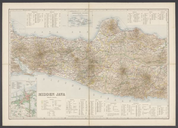
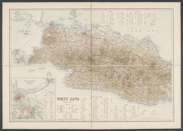
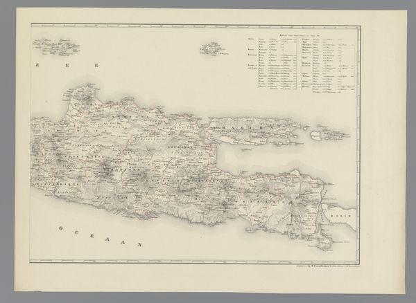
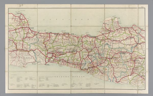
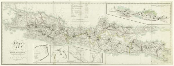
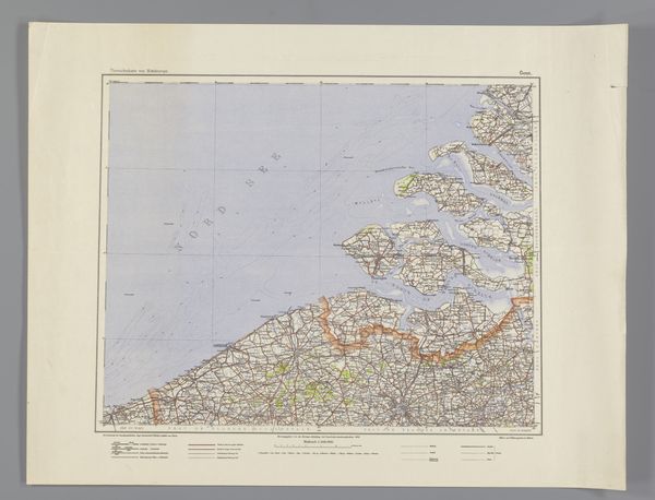
Dimensions: height 655 mm, width 920 mm
Copyright: Rijks Museum: Open Domain
Editor: So, here we have a detailed print, a map of East Java from 1906 by Topografische Inrichting. It's incredibly intricate. There's something about seeing a landscape so meticulously rendered that gives it a sense of authority. How would you interpret this map through a historical lens? Curator: A fascinating piece! Consider the date, 1906. Java was then part of the Dutch East Indies, a colony exploited for its resources. This map isn't just a geographical document, it’s an instrument of colonial power. Think about how such detailed cartography was crucial for resource extraction, military control, and bureaucratic administration. It's not a neutral representation, but rather a projection of dominance onto the landscape. Does seeing it this way shift your perception? Editor: It does, it makes me consider who commissioned this map and for what purposes. The detailed depiction, intended to simply be informative, takes on a darker, more complex meaning. Curator: Precisely. And think about the audience. This level of detail wouldn't have been particularly useful to the average Javanese person. It's geared towards a European, most likely Dutch, audience – officials, traders, military personnel – individuals who would directly benefit from the colonial project. The map reinforces their position of knowledge and control. What implications can we draw from its "realist" style? Editor: If it adopts "realism", it’s interesting how that choice presents a presumed accuracy or objective truth, seemingly erasing the subjective, culturally biased perspective of its creators and primary audience. I now see the map's role in enabling and legitimizing colonial power. Thank you. Curator: It also raises important questions about the representation of colonized lands and the ethics of visual culture within imperial contexts. A seemingly straightforward object holds many layers.
Comments
No comments
Be the first to comment and join the conversation on the ultimate creative platform.
More like this