drawing, print, paper, ink, engraving
#
drawing
# print
#
old engraving style
#
paper
#
ink
#
islamic-art
#
engraving
Dimensions: height 274 mm, width 216 mm
Copyright: Rijks Museum: Open Domain
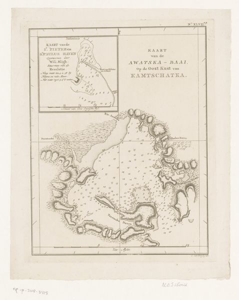
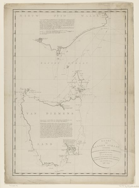
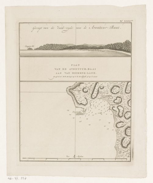
This is an unauthored map detailing the coasts of Malakula, New Caledonia, and Tanna. The most visually arresting symbol is the compass rose, which guides the viewer through space but also serves as a potent reminder of humanity's drive to explore and chart the unknown. This symbol has its roots in antiquity, echoing the celestial maps of the ancient world, where cardinal directions intertwined with spiritual beliefs. Consider how the compass, initially a tool for navigation, became laden with cultural meaning. Its needle pointed not just to the North but toward progress, and in the psychoanalytic realm, it signifies a yearning for direction. Yet, as the compass guided explorers, it also ushered in profound cultural shifts, intertwining the fates of distant lands. Notice how the map is a testament to our collective memory and ambition. The very act of mapping, of imposing order onto the natural world, speaks volumes about human consciousness. It persists, reappears, and evolves, forever colored by the shadows of our past.
Comments
No comments
Be the first to comment and join the conversation on the ultimate creative platform.
More like this