print, engraving
# print
#
landscape
#
geometric
#
line
#
engraving
Dimensions: height 522 mm, width 632 mm
Copyright: Rijks Museum: Open Domain
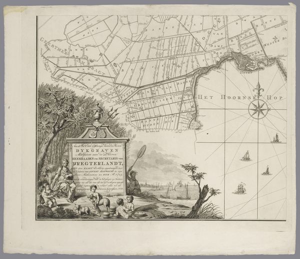
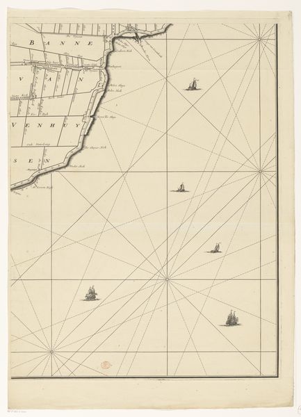
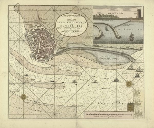
Curator: Let’s discuss this map, "Kaart van het dijkgraafschap Drechterland (deel linksonder)," created around 1775 by an anonymous artist, rendered as an engraving. It details a region in the Netherlands. What's your immediate take? Editor: Stark. A network of fine lines attempting to capture both the land and open sea. It feels very precise, but also somewhat detached—like a surveyor's clinical record. Curator: Well, remember that maps of this era were tied intrinsically to power—they delineated ownership, defined territories for trade and resource extraction, and obviously had significant geopolitical ramifications in terms of military maneuvering. Mapping practices served colonial and commercial ambitions hand-in-hand. This detailed section shows the hydrography of Drechterland, including the intricate dyke system protecting the lowlands. We see that reflected here. Editor: The geometric framework dominates. Those precise lines creating a rigid grid, overlaying the natural curves of the coastline. There’s a tension between imposed order and natural form here that I find interesting. It calls attention to the relationship between humankind and their spatial environments, right? Curator: Exactly! Notice how the presence of people is minimal but poignant. You can make out those tiny ships. The figures at the bottom are interacting with a structure extending into the water. Editor: And the scale! Look at the contrast in size between these individuals and the imposing grid laid upon the scene. They’re almost comical. Do they function as a reflection on mankind's ability to take ownership over water? Curator: Perhaps, but think also of the sheer labor involved in constructing and maintaining dykes—entire communities were involved. The map represents a collective effort, both the effort of surveying and recording. Editor: So even the stark presentation isn't devoid of human element. Even here, in something intended as a guide or a tool, the people make their marks upon this space. Curator: Right! The intersection of the functional and historical really deepens our understanding. Editor: I am struck at the composition here in closing. What at first appears to be purely scientific reveals subtle depths after all. Curator: A telling detail about both cartography and this historic area. Thanks for providing fresh insights.
Comments
No comments
Be the first to comment and join the conversation on the ultimate creative platform.
More like this