print, engraving
#
dutch-golden-age
# print
#
cityscape
#
engraving
Dimensions: height 511 mm, width 574 mm
Copyright: Rijks Museum: Open Domain
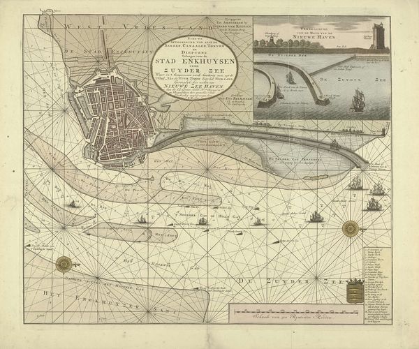
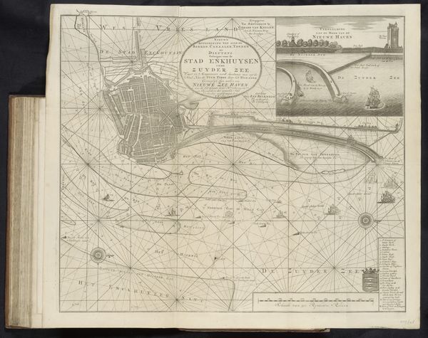
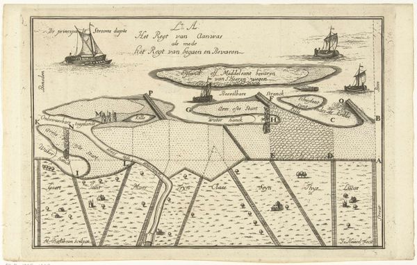
Editor: This print, titled "Kaart van het water voor Enkhuizen met de geprojecteerde nieuwe haven," or "Map of the waters for Enkhuizen with the projected new harbor," created in 1720, depicts a detailed view of a coastal city. I am immediately struck by how it blends practical navigation with artistry. How do you see the cultural narrative within this map? Curator: This map is so much more than simple navigation. The proposed harbor and careful rendering of waterways suggest a deep belief in human mastery over nature. The lines connecting points, the placement of ships – these become symbols of trade, of power, of connection across the sea, mirroring the Dutch Golden Age's ambition. What do you think that level of detail implies about the intended audience? Editor: It feels like it's intended for merchants, perhaps city planners… someone who needs to understand the economic arteries of the city, or someone interested in imagining that. Curator: Exactly! Think of the symbolic weight of the "sea" itself. In many cultures, the sea is untamable and menacing; a good example can be seen in Turner’s later seascapes. However, here, the sea is quantified, organized, even inviting through its labeling. Every detail—ships, depths, and proposed construction—resonates with cultural ambitions. Editor: So, you're saying that even the act of mapping transforms the sea into a symbol of something manageable and exploitable? Curator: Precisely. It transforms it from a threat into a resource. And isn't that at the heart of what the Dutch Golden Age was about: a transformation of their world through ingenuity and commerce? This single image, therefore, is imbued with cultural values, expressing mastery, prosperity and technological advancements that shaped its era. Editor: I never thought about a map holding so much cultural information. Looking at it now, I see it’s not just geography, it’s history and psychology etched onto paper. Curator: Indeed. Maps often betray the priorities of those who commission them. That is perhaps the greatest lesson they have to offer.
Comments
No comments
Be the first to comment and join the conversation on the ultimate creative platform.
More like this