About this artwork
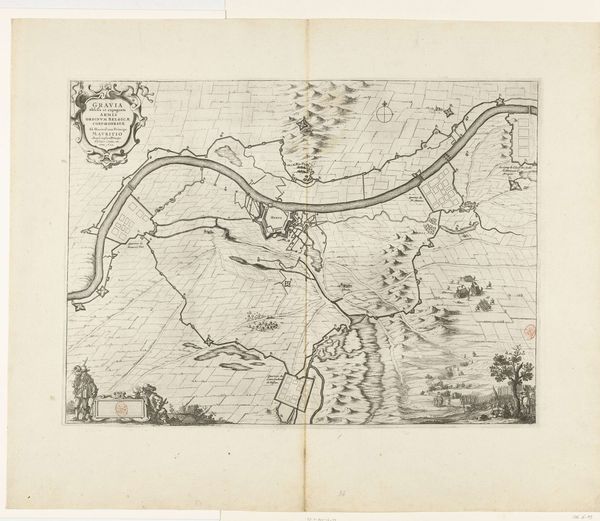
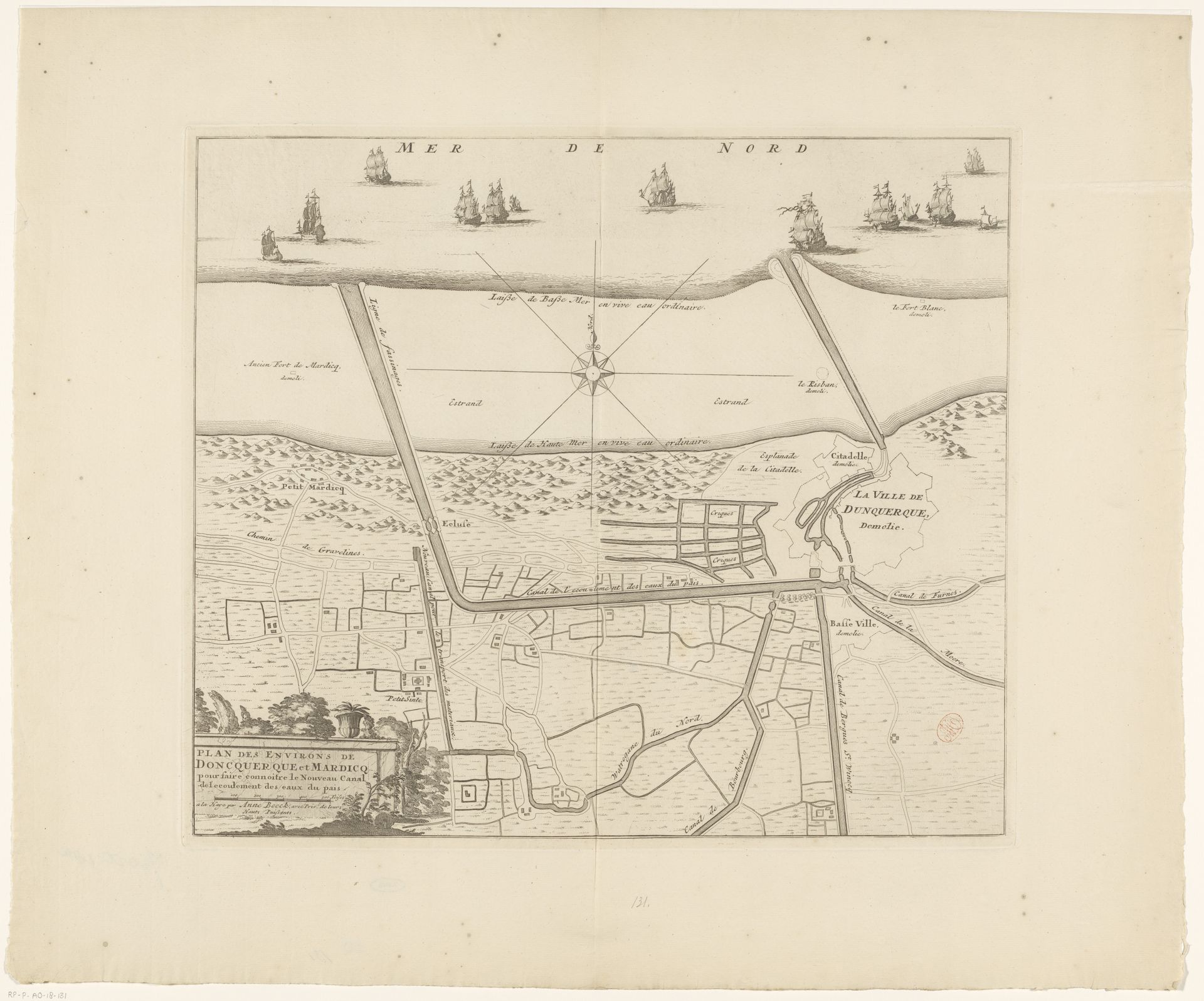
Editor: This etching, "Kaart met de kanalen van Duinkerke," dating from after 1713, is by an anonymous artist and it depicts a map. The precision is captivating, yet I am curious: What elements do you focus on when approaching such a meticulously detailed cityscape like this? Curator: It is the interplay of line and form that initially captures my attention. Notice the contrasting textures: the meticulous geometric precision used to represent the urban area juxtaposed with the more fluid and organic depiction of the coastline and ships. The cartographer's deliberate arrangement creates a visual hierarchy, inviting the eye to navigate the image in a structured manner. How does this structured composition affect your interpretation of the artwork’s message? Editor: I find that it creates a sense of order and control over the space represented, a desire to understand and categorize the world. Almost like a military campaign! What is the impact of using an etching medium for a cartographic artwork, do you think? Curator: The etching technique allows for an extraordinary level of detail, facilitating a clear delineation of the complex network of canals and fortifications. The monochrome palette further accentuates the linear structure. It abstracts the colours in real life in order to convey precision above all else, which adds to the work's scientific, objective and intellectual sensibility. In the absence of colour or scale indications, the intrinsic lines and their relationships define its meaning. Editor: I see that now! It's less about pictorial representation and more about the underlying structural relationships. Thanks! Curator: Indeed! Close observation unveils a new layer of comprehension. This focused lens lets us recognize the artistry that's possible, even within cartography.
Artwork details
- Medium
- print, etching
- Dimensions
- height 397 mm, width 458 mm
- Location
- Rijksmuseum
- Copyright
- Rijks Museum: Open Domain
Tags
Comments
Share your thoughts
About this artwork
Editor: This etching, "Kaart met de kanalen van Duinkerke," dating from after 1713, is by an anonymous artist and it depicts a map. The precision is captivating, yet I am curious: What elements do you focus on when approaching such a meticulously detailed cityscape like this? Curator: It is the interplay of line and form that initially captures my attention. Notice the contrasting textures: the meticulous geometric precision used to represent the urban area juxtaposed with the more fluid and organic depiction of the coastline and ships. The cartographer's deliberate arrangement creates a visual hierarchy, inviting the eye to navigate the image in a structured manner. How does this structured composition affect your interpretation of the artwork’s message? Editor: I find that it creates a sense of order and control over the space represented, a desire to understand and categorize the world. Almost like a military campaign! What is the impact of using an etching medium for a cartographic artwork, do you think? Curator: The etching technique allows for an extraordinary level of detail, facilitating a clear delineation of the complex network of canals and fortifications. The monochrome palette further accentuates the linear structure. It abstracts the colours in real life in order to convey precision above all else, which adds to the work's scientific, objective and intellectual sensibility. In the absence of colour or scale indications, the intrinsic lines and their relationships define its meaning. Editor: I see that now! It's less about pictorial representation and more about the underlying structural relationships. Thanks! Curator: Indeed! Close observation unveils a new layer of comprehension. This focused lens lets us recognize the artistry that's possible, even within cartography.
Comments
Share your thoughts