drawing, print, ink, engraving
#
drawing
#
baroque
#
pen drawing
# print
#
landscape
#
ink
#
geometric
#
line
#
cityscape
#
engraving
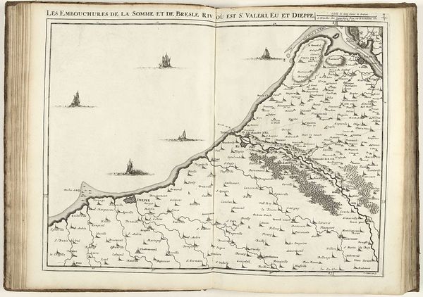
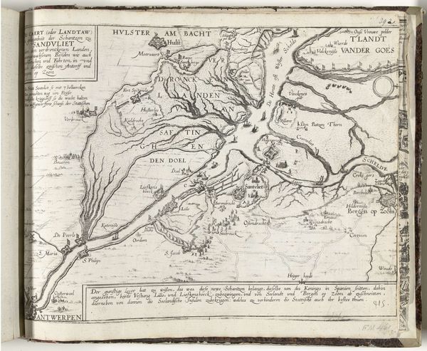
Dimensions: height 421 mm, width 555 mm
Copyright: Rijks Museum: Open Domain
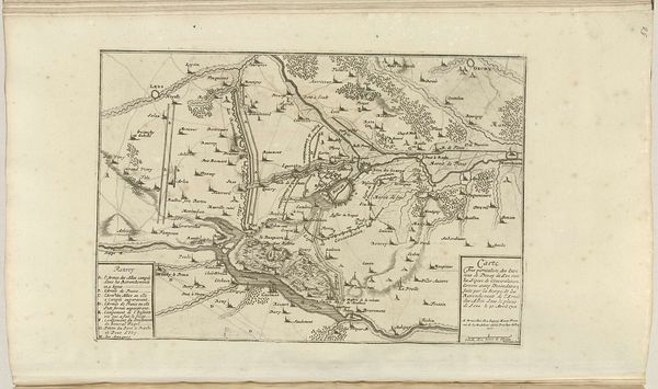
Editor: Here we have Jacobus Harrewijn's "Map of the North French Coast," created in 1707. It's a wonderfully detailed ink and pen drawing, almost entirely in line work. The meticulous execution is quite impressive! How would you approach understanding this piece? Curator: I'm immediately drawn to the linework. Notice how Harrewijn uses variations in the thickness and density of lines to create a sense of depth and texture. The overall structure of the map relies almost exclusively on this graphic quality. It defines everything from landmasses and waterways to individual buildings. Editor: So, you are looking at how the components work together. I can see that. What does that suggest? Curator: Precisely. The composition relies on a network of interconnected lines, creating visual pathways for the eye to follow. What shapes emerge as significant visual units? Are the land divisions of equal visual weight? Is there any element that guides our eye more intentionally? Editor: Well, the waterways seem like an intentional feature because they contrast with the geometric lines on the far left. Curator: A keen observation! Consider, though, how those 'geometric lines' on the left and the irregular ones across the middle contrast. Does this assist in identifying points of geographic transition and understanding the coastal terrain through pure formal cues? Also, what is the impact of a purely monochromatic palette, a common visual language in mapping? Editor: That is something I did not consider. Viewing the land divisions or waterways through the linework provides insights beyond just geographical interpretation. Thank you! Curator: Indeed! By understanding the use of form, line, and space, we have new perspectives into its function and expression as art.
Comments
No comments
Be the first to comment and join the conversation on the ultimate creative platform.
More like this