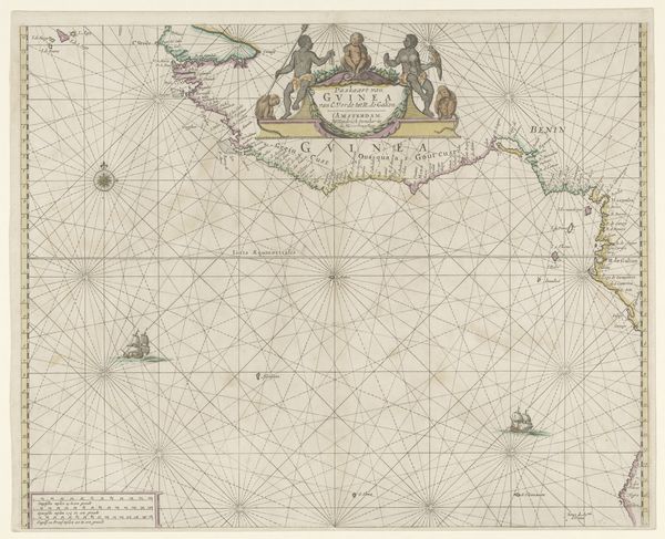
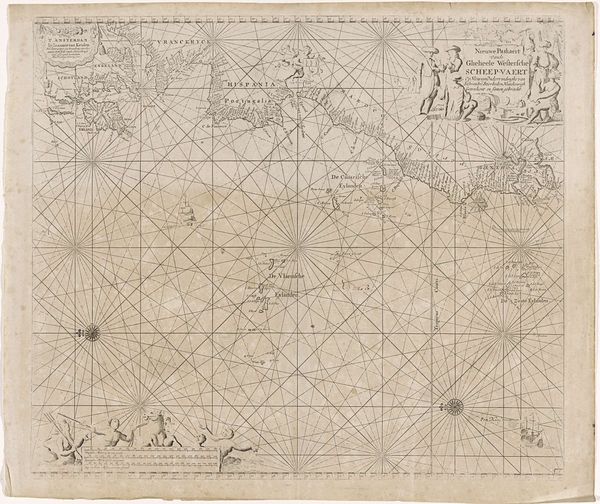
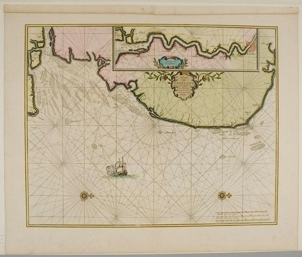
Zeekaart van de noordoostkust van Amerika, bij het toenmalige Nieuw-Amsterdam 1666
0:00
0:00
anonymous
Rijksmuseum
print, etching, paper, ink, engraving
#
water colours
#
dutch-golden-age
# print
#
etching
#
landscape
#
paper
#
ink
#
genre-painting
#
engraving
#
watercolor
Dimensions: height 437 mm, width 546 mm
Copyright: Rijks Museum: Open Domain
Curator: Here we have a map from 1666 titled "Zeekaart van de noordoostkust van Amerika, bij het toenmalige Nieuw-Amsterdam." It depicts the northeast coast of America, during the time when New York was still known as New Amsterdam. Editor: Immediately, I'm struck by the tension between the implied vastness of the ocean, rendered as an open grid, and the intimate details etched onto the coastline. It makes me feel the weight of those journeys across the sea. Curator: Yes, those stark grids serve a navigational purpose but also speak to an imposed order on a "new" world. I'm drawn to how the printmaking—the etching and engraving—renders not just landmass but also an atmosphere. You almost feel the salty spray. Editor: Absolutely. Consider the paper itself— likely linen-rag based. A tangible connection to the era's textile production. And the ink! Analyzing its composition could reveal trade routes, material sourcing. Even the watercolors seem purposefully subdued, almost whispering a tale of resources extracted. Curator: It makes you ponder who was this map *for*? Clearly someone who valued both the pragmatic details for sailing and something more decorative for display. The embellishments around the title suggest an element of status and pride. Editor: Exactly! Mapping wasn't just about finding your way. It was about claiming territory, controlling resources, and, quite frankly, exploiting labor to extract those resources in the first place. Each color choice, each line's weight is an articulation of power dynamics. Even down to who had the literacy and privilege to engage with cartography in the first place. Curator: Indeed. It's fascinating how an object like this, ostensibly about objective geography, holds so much subjectivity and colonial intent. It’s a reminder that even the most "factual" representations are loaded with perspective. Editor: Precisely. Analyzing the map through its very materials grounds us in the economic and social realities that birthed it. The act of *making* reveals the human ambition—and the often-overlooked cost of progress—embedded within. Curator: Considering it's displayed at the Rijksmuseum adds another layer, prompting contemplation on how national identity and narratives evolve and become reframed over centuries. Editor: Exactly, tracing the map's physical journey through collections reveals a parallel journey through the shifting values placed upon its original purpose and lasting impact.
Comments
No comments
Be the first to comment and join the conversation on the ultimate creative platform.
More like this