graphic-art, print, engraving
#
graphic-art
# print
#
old engraving style
#
geometric
#
decorative-art
#
engraving
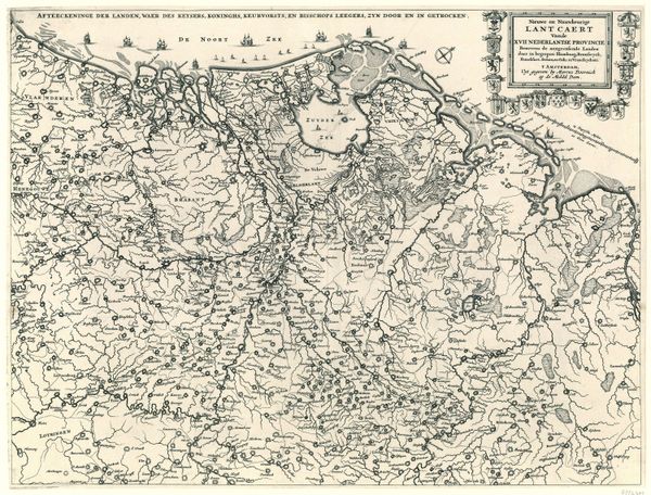
Dimensions: height 240 mm, width 203 mm
Copyright: Rijks Museum: Open Domain
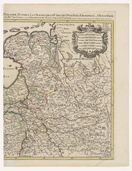
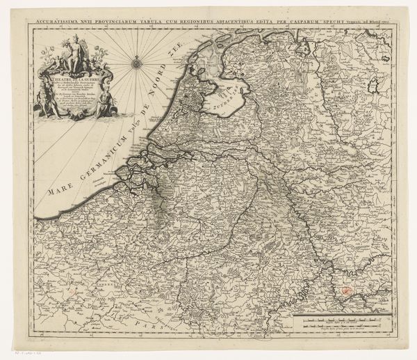
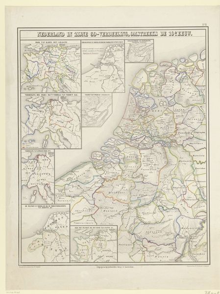
Curator: This is a map entitled "Kaart van de Bourgondische kreits, 1512." Although the name implies an older creation, it was actually produced sometime between 1853 and 1861 by an anonymous artist. Editor: My initial reaction is that it’s incredibly intricate. All those fine lines! The delicacy suggests painstaking labor; the artist's tools are clearly capable. Curator: Indeed. As a print—more specifically, an engraving—its production would have involved considerable skill. It isn't simply about artistry; it reflects an artisanal process that intertwines labor, material knowledge and craft. Note the pressure and its distribution on the lines to shape the contours of territories, using a method with established conventions to express something material. Editor: That level of detail, think about its practical purpose, maps have always served political power. This depicts the Burgundian Circle. It’s not just geography; it is a statement about jurisdiction and influence. The mapmakers in 1853 are engaging in their own time with an almost-vanished territorial order. Curator: Good point. One wonders about the choice of engraving, which evokes historical accuracy and craftsmanship in its printing process, when there were many new options, this would resonate with its potential buyers, perhaps reflecting a desire for permanence or stability amidst social and political shifts. What was the context? Editor: Certainly a moment of self-definition. Maps also instruct—consider how schools were being standardized in this era, so the images taught values and a certain way of visualizing your place within the national space, which is shaped through institutions. Curator: It brings the idea of accessible instruction to mind, as we think of this map’s existence today displayed behind the walls of the Rijksmuseum. It reveals so much information to the patient observer of process, cultural agenda and the history of places in a single image. Editor: It is also a testament to how political landscapes can outlive physical terrains as these lines exist well beyond political agreements.
Comments
No comments
Be the first to comment and join the conversation on the ultimate creative platform.
More like this