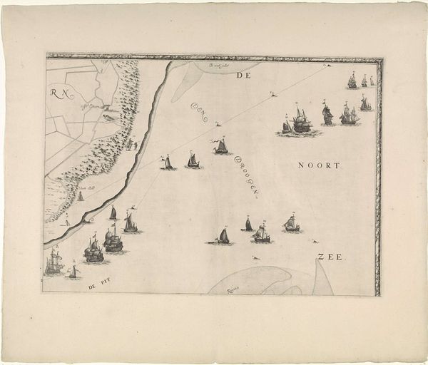
Kaart van de baai tussen Ellesmere-eiland te Canada en Groenland 1836 - 1912
0:00
0:00
isaacweissenbruch
Rijksmuseum
drawing, print, photography, engraving
#
drawing
# print
#
landscape
#
photography
#
geometric
#
engraving
Dimensions: height 133 mm, width 117 mm
Copyright: Rijks Museum: Open Domain
Curator: Welcome. We're standing before an intriguing print titled "Kaart van de baai tussen Ellesmere-eiland te Canada en Groenland," which roughly translates to "Map of the Bay Between Ellesmere Island in Canada and Greenland." It's a composite work from between 1836 and 1912. Editor: My immediate reaction is one of coolness. The muted grey palette and stark lines really convey the remoteness of the Arctic. The lines, gradations of shade—they create a real sense of volume in the icy terrain. Curator: It's a visual record of exploration, but also, a colonial endeavor, isn't it? Each place name is a story of Arctic exploration. Names of explorers plastered over the Indigenous presence... a symbolic act of claiming territory through mapping. The act of naming itself carries so much weight. Editor: Precisely, but it's the contrast of those soft, almost misty landmasses with the rigidity of the latitudinal and longitudinal lines that arrests my eye. Look at the forms of Ellesmere and Greenland. They evoke vast, imposing presence. The interplay creates a dynamic tension. Curator: These cartographic efforts served specific geopolitical interests, defining territories for resource control, trade routes. Think about what it meant for the Inuit populations whose territories were being codified in ways entirely alien to them. This map also reflects scientific curiosity. Knowledge production intertwined with colonial agendas. Editor: True, but even removed from context, the piece creates a real aesthetic impression, divorced from these concerns—lines, shapes, the shades all harmonise in the print. Curator: Can we ever divorce art from its context? Or should we acknowledge those tangled webs of power that inform even what seems purely aesthetic? Considering these complexities lets us reckon with the problematic history while acknowledging its formal mastery. Editor: I see your point. By closely reading it, this print really is more than simply topography; its history enriches our understanding as well as shapes our understanding of place. Curator: Exactly. Editor: It adds nuance, for sure. Thank you.
Comments
No comments
Be the first to comment and join the conversation on the ultimate creative platform.
More like this