print, etching
#
dutch-golden-age
# print
#
etching
#
landscape
#
etching
Dimensions: height 457 mm, width 539 mm
Copyright: Rijks Museum: Open Domain
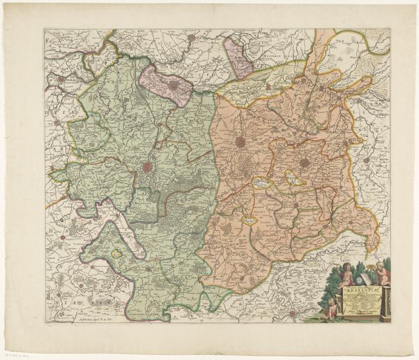
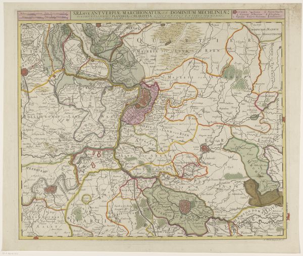
This map of the Eastern part of Brabant was made anonymously, sometime in the early modern period. It embodies a crucial moment in the history of early modern Europe, when maps became not just geographical tools but instruments of power. Notice how the regions are carefully delineated by colour. This wasn’t just about showing where things were, but about asserting control and defining territories. The detailed rendering of towns, rivers, and roads served a purpose, aiding military planning and economic exploitation. Maps like these were commissioned by rulers and merchants, reflecting their interests and ambitions. The social conditions of the time – constant warfare, rising mercantilism, and competing political powers – shaped its creation. By studying such maps, alongside archival documents and historical texts, we can uncover the political and economic forces that influenced its production, revealing a complex picture of power, knowledge, and representation in the early modern world.
Comments
No comments
Be the first to comment and join the conversation on the ultimate creative platform.
More like this